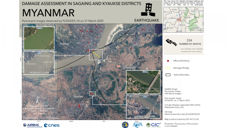
Damage Mapping of the Myanmar Earthquake by the Geoinformatics Center (GIC)
On March 28, 2025, a powerful magnitude 7.7 earthquake struck near Mandalay, Myanmar, according to the United States Geological Survey (USGS). The quake occurred along the Sagaing Fault, a major tectonic boundary that separates the Indian Plate from the Eurasian Plate. Tremors were felt as far away as Bangkok, nearly 1,000 kilometers from the epicenter.
In response to this catastrophic event, the Geoinformatics Center (GIC) produced a series of satellite-derived post-disaster map products for the most affected areas, including Sagaing and Kyaukse districts. For the impact assessment, pre-disaster imagery from ESRI’s World Imagery (30 cm resolution) and post-disaster imagery from Airbus’s PLEIADES-1A (50 cm resolution) were used to identify and analyze the extent of the damage. GIC produced two Value Added Products (VAP) for this earthquake on 31 March 2025.