Application of Multi-temporal Satellite Data for Land-Use/Land-Cover Change and Flood Mapping in the Coastal Zone of Vietnam
Descriptions
The objectives of this project were: 1) To develop a methodology for landcover/landuse mapping using JERS-SAR and JERS-OPS, 2) To understand the temporal changes of the landuse/ landcover types, 3) To produce a flood extent map for landuse planning and management.
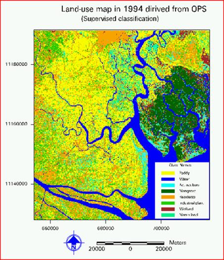
The study area of this project was Mekong delta in the coastal region of Vietnam. JERS-OPS and JERS-SAR images of 1994 were registered in UTM projection, a commonly used coordinate system in Vietnam. In this process, the OPS image was re-sampled to the same resolution as the SAR image (12.5m) and co-registered with Landsat as a base image to ensure the precision. PCA (Principal Component Analysis) and NDVI (Normalized Difference Vegetation Index) were generated from the OPS image. Lee filter with a kernel size of 3×3 was applied to reduce speckle noise in the SAR image and backscatter was calculated. Different combinations of bands were used for unsupervised and supervised classifications to generate land-cover land-use maps. Comparison between the 1989 and 2000 classification results, a decrease in the area of paddy fields, mangrove and marshlands was observed. To estimate the flood area, two Landsat images were used, one image at 1989 during the dry season and another image at 2001 during a massive flood. Land and water areas were identified using Near Infra Red (NIR) and Thermal Infra Red (TIR) bands. In these two bands, low reflectance was observed in the water areas and high reflectance in the land areas. By subtracting the water area of the flood image and the dry season image, the flood map of the study area was derived. It was found that the November 2000 flood had inundated an area of 10,718 km2 (35%) of the study area.

