Flood Hazard Mapping and Vulnerability Analysis in Kathmandu Municipality
Year: 2009-2010
Country: Nepal
Location within country: Kathmandu
The objectives of this project were: 1) To map the flood hazard in Bishnumati river in a GIS environment, 2) To conduct the flood vulnerability analysis.
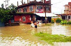
The issue of urban flooding got attention when Kathmandu was flooded in 2002 by the Bishnumati River with total casualties of 27.
Descriptions
In this project, flood hazard maps of 10, 20, 50 and 100 year return periods were prepared for the Kathmandu municipality. The model selection was the one-dimensional model Hec-RAS. The necessary inputs for the model were obtained from various relevant agencies in Nepal including the river cross sections and hydrological data for 30 years. Landuse map was prepared from ALOS/AVNIR-2 and ASTER images. The landuse map was utilized for determining the manning’s roughness coefficients for the model. The outputs obtained from the model were the depth and extent of floods for different return periods. These hazard maps were further utilized in a more detailed vulnerability analysis. The population per affected Village development Committees (VDC) was estimated using the 2001 census data. This total population was converted to population grids of 10×10 m pixel within the VDCs. A simple overlay of the flood hazard maps over the population grid had provided the population affected for a flood of a given intensity. The numbers of buildings affected were obtained in the same way of overlaying these hazard maps over the building footprints. High vulnerability was found in the urban areas due to the high density of population. Further analysis showed that most of the buildings were inundated by a flood depth of 1.5m. Approximately 35,000 people are likely to be directly affected by a flood of 100 year return period.

