Flood Hazard Mapping in Three Provinces in Cambodia Under Mekong Basin
Descriptions
The objective of the project was to prepare a flood hazard map in the Mekong River basin covering in Kampong Cham, Kandal and Prey Veng Provinces of Cambodia. Study area covered 3 provinces, 26 districts and 305 communes.
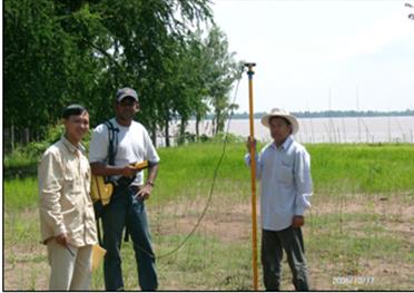
Elevation data were collected along the riverbanks using a differential GPS for a length of 139 km as good DEM was not available for the study area Existing spot heights available in the Geography Department of Cambodia and the Mekong River Commission were also added to the elevation data collected. A flood map for the year 2000 was produced using Mike-11 model, which was one of the worst flood experienced in the Mekong basin in recent past. The land use map of the study area was updated using Landsat-TM and ALOS-AVNIR-2 satellite images and used as input to the flood model. The model simulated flood extent closely matched with the flood map delineated from RADARSAT image acquired during the year 2000 flood. Results showed that 50% of the schools and a large population (approximately 720,000) in the floodplain were affected during the flood of year 2000

