Overview
The two-week training on Drone Image Processing and Analysis for Glacier Monitoring was held from April 28 to May 9, 2025, and focused on building the technical skills needed to monitor glaciers using drones. Three officers from the National Centre for Hydrology and Meteorology (NCHM) of Bhutan, attended the two-week training program. With Bhutan’s glaciers under increasing threat from climate change, leading to risks like glacial lake outburst floods (GLOFs), water shortages, and unstable ecosystems, this training aimed to promote better glacier monitoring practices using drone-based technologies.
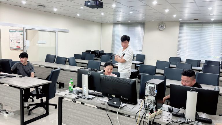
Participants learned how to plan and carry out drone surveys and process high-resolution imagery for glacier mapping and analysis. The course combined classroom lectures with extensive hands-on practice using DJI Mavic 3 Enterprise drones, Global Navigation Satellite System (GNSS RTK) systems, and tools like DJI Terra, WebODM, SW Maps, Cloud Compare, and QGIS.
Training Highlights
Week 1 focused on the basics—introducing drones, remote sensing concepts, Ground Control Points (GCPs), Image processing, and GIS.
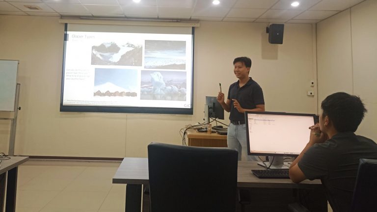
- April 28 (Day 1): The training opened with remarks from our director, Dr. Manzul Kumar Hazarika. Mr. Thanaphol Boodchuang introduced remote sensing with drones, and Mr. Swun Wunna Htet introduced drone applications for glacier monitoring. This was followed by drone flying practice for participants
- April 29 (Day 2): Mr. Thanaphol led sessions on aerial mapping and planning drone missions. The hands-on part focused on automated drone flights for mapping.
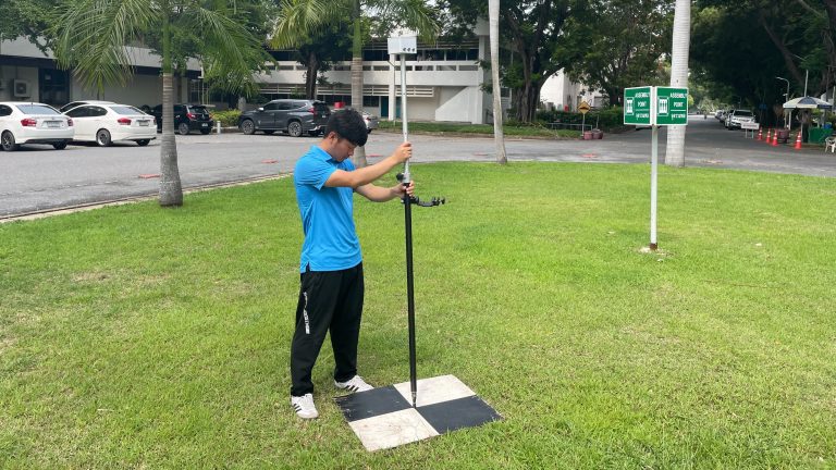
- April 30 (Day 3): Discussion was conducted on collection of Ground Control Points (GCPs) and using RTK systems, followed by a full day of GCP collection and drone mapping.
- May 1 (Day 4): Mr. Thanaphol discussed photogrammetry concept. Participants used WebODM and DJI Terra to produce orthomosaics, DEMs, and contours.
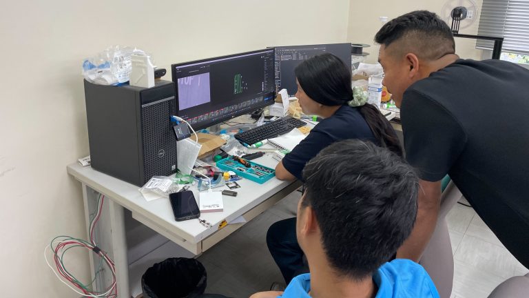
- May 2 (Day 5): Mr. Syams Nashrullah led sessions on drone laser scanning, working with point clouds using Cloud Compare, and creating 3D models.
Week 2 covered more advanced topics like glacier analysis, data processing software, and group project work.
- May 5 (Day 6): Mr. Swun gave lecture on glacier dynamics estimation for Part 1 and gave practical session using Google Earth Engine.
- May 6 (Day 7): Part 2 continued with additional lecture and practical work on glacier analytics and glacier mapping using machine learning using Google Earth Engine.
- May 7 (Day 8): Mr. Dwijendra Kumar Das introduced participants to WebODM and pyODM, and co-led a session with Mr. Thanaphol on image processing with pyODM using participants’ data.
- May 8 (Day 9): Participants worked in groups to apply what they had learnt, using either sample or custom datasets. The training concluded with a final presentation by each of the participants on topics-glacier mapping, DEM analysis, and change detection and a wrap-up session.
The training brought participants to gain their firsthand experience in flying drones and processing imagery. They learned how to create orthomosaics photos, digital elevation models (DEMs), and contour maps, and to detect glacier changes over time. The course also emphasized integrating drone data into GIS platforms for effective visualization and analysis. By the end, participants were equipped to independently carry out glacier monitoring tasks and apply geospatial techniques in their work.