GIC was participated in the virtual event on the “Latest advancements on PyAEZ, an innovative free and open-source application for land evaluation”. This virtual event jointly organized by the Food and Agricultural Organization (FAO), mainly talks about the advancement of PyAEZ. The talks was based on the methodology of AEZ (Agro-ecological Zonation), which PyAEZ was demonstrated to showcase the latest advancement on the technical improvement, potential applications with PyAEZ and the demonstration of PyAEZ incorporated into ArcGIS online.
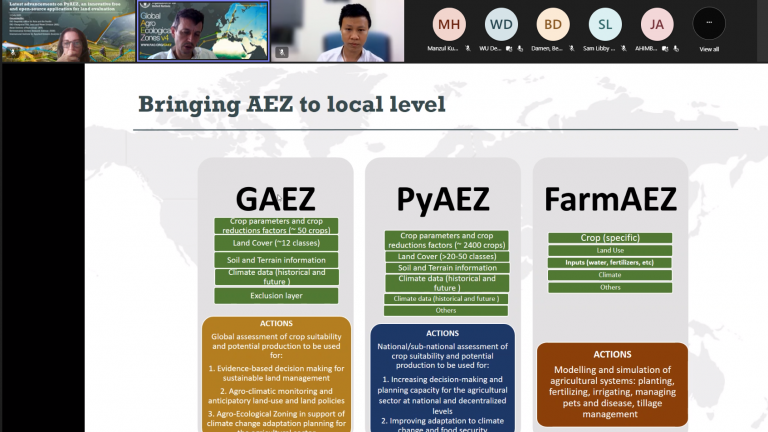
AEZ is a well-established modelling system for land evaluation to support sustainable land-use planning, stimulate agricultural investments, monitor agricultural resources’ status, and assess climate change’s impacts on agriculture. The methodology of AEZ was developed by FAO and International Institute for Applied Systems and Analysis (IIASA).
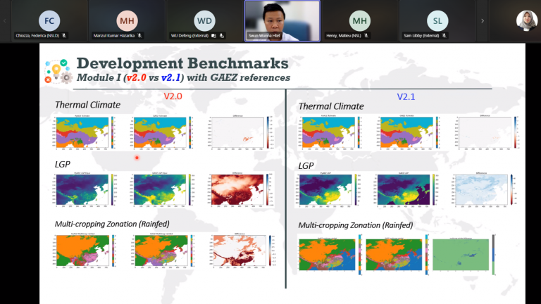
GIC Research Associate, Mr. Swun Wunna Htet, presented the latest advancement of PyAEZ. He highlighted the PyAEZ updates on the modification on Module I, II, and III which having more consistent algorithms regarding GAEZ outputs. More detailed of module information can be found on the repository (github.com/gicait/PyAEZ). The current advancement version, which is PyAEZ v.2.1, has been improved to enhance system user-friendliness and more informative outputs from Modules. He highlighted the in technical remarks about the recent development done in PyAEZ v2.1, including validation, new implementations to Module II and III, and explained future developments.
Later on, the utility of PyAEZ will be focused on the research outputs of the GAEZ users. More information regarding the Global Agro-ecological Zonation can be found in gaez.fao.org/pages/pyaez.