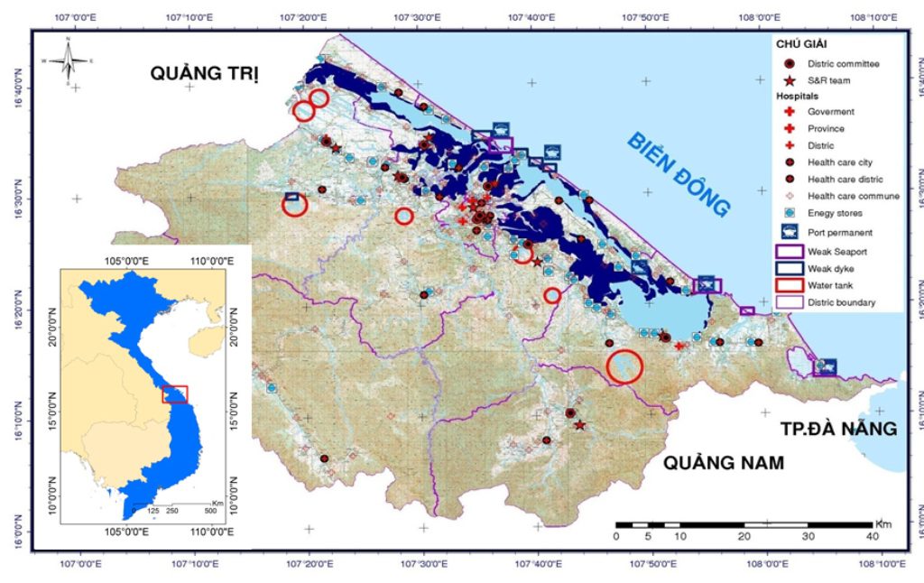
Rapid Flood Mapping in Hue Province of Vietnam for Emergency Response and Rescue using Satellite Images
Descriptions
The aim of the project was to develop a method for rapid flood mapping in the Hue province for emergency response and rescue. A methodology for rapid flood mapping was developed using ALOS/PALSAR satellite data and the flood map derived was verified with the field data.
In this project it was found that most of the industrial and residential areas in the province are exposed to flood. A flood model was used to delineate the extent and depth of flood. A threshold method used also used to classify flood and non-flood areas from the satellite images and it was quite close to model-simulated results. However, deriving flood extent from satellite image was much faster and easier to implement than carrying out modeling. Rapidly generated flood map from satellite data can be used to show the evacuation points for emergency response and rescue.

