
GIC teamed up with the Remote Sensing Technology Center of Japan (RESTEC) to hold an online five-day training course to strengthen Indonesia’s capacity for reconstruction monitoring with geospatial technology from July 12 – 16, 2021.
This training course was the second module in a series of six training courses that were prescribed by the Asian Development Bank (ADB) to assist with Indonesia’s rebuilding effort in the wake of the devastating 2018 Sulawesi earthquake.
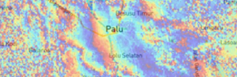
Training Module 2 focused on building participants’ capacity for land stability monitoring with time series analysis of synthetic aperture RADAR (SAR) data. Participants also gained valuable experience in processing open source SAR data in the Geohazard Exploitation Platform, a cloud based solution for on-demand processing of large scale data. Technical sessions were handled by representatives from GIC, Diponegoro University – Indonesia (Ind: UNDIP), RESTEC, and National Institute of Aeronautics and Space – Indonesia (Ind: LAPAN).
The thirty participants who took part in the training course represented a number of Indonesian government institutions, including: LAPAN, the Geospatial Information Agency – Indonesia (Ind: BIG), the Meteorology, Climatology, and Geophysical Agency (Ind: BMKG), Bappeda Sigi, and the National Geology Department.
Module 3 is scheduled for 4th Quarter 2021 and will continue land stability monitoring by honing on building-level stability through spatial modeling techniques.