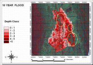
Flood Hazard Mapping using HEC-RAS, Remote Sensing and GIS: A Case Study of Xe Champhone River in Savannakhet Province, Lao PDR
Flood Hazard Mapping using HEC-RAS, Remote Sensing and GIS: A Case Study of Xe Champhone River in Savannakhet Province, Lao PDR Year: 2007-2008Country: Lao PDRLocation within country: Xe Champhone river basin, Savannakhet province Descriptions The objectives of this project Read More


