Earth Observation for Nationals Agriculture Statistics
Area : Thailand and SEA Client : FAO Start Year : Dec 2021 End Year : Nov 2022 Partners : –
Strengthen Technical Capacity of National Officials to Use Earth Observation (EO) Data to Better Collect and Disseminate Agriculture Statistics
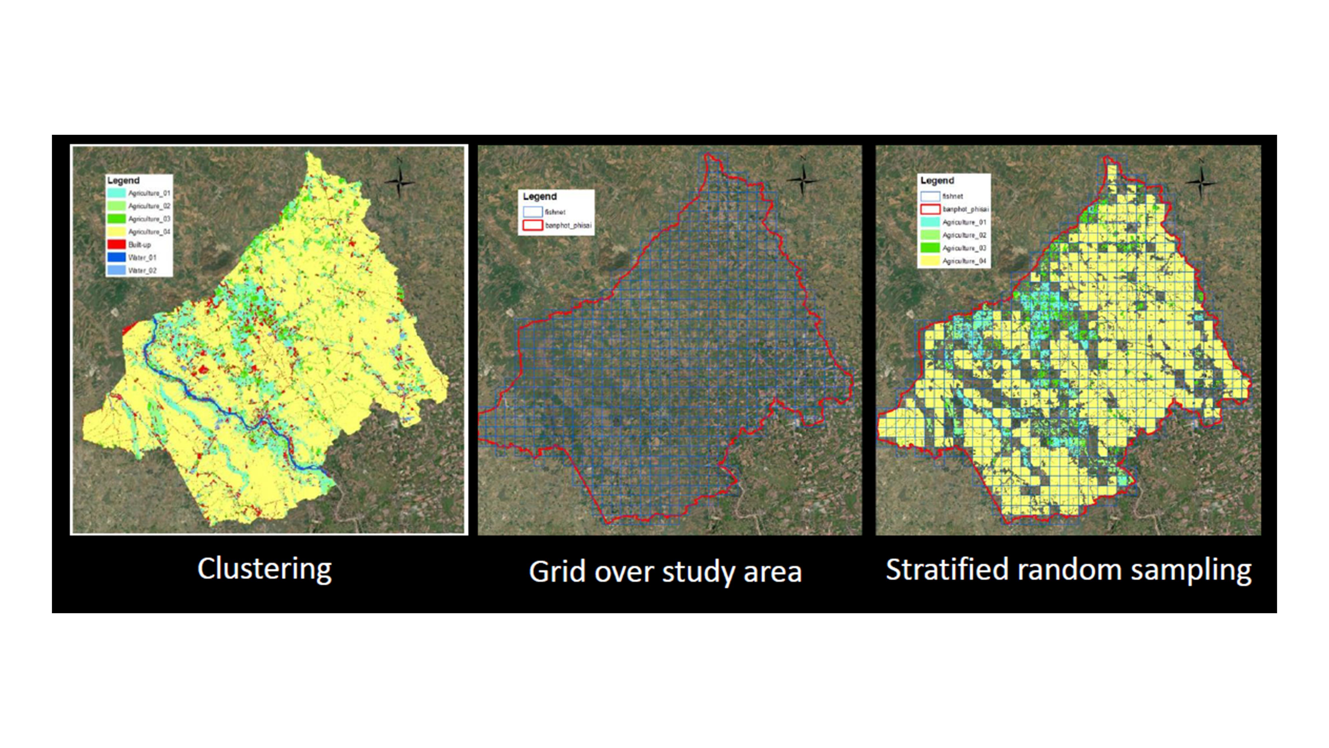
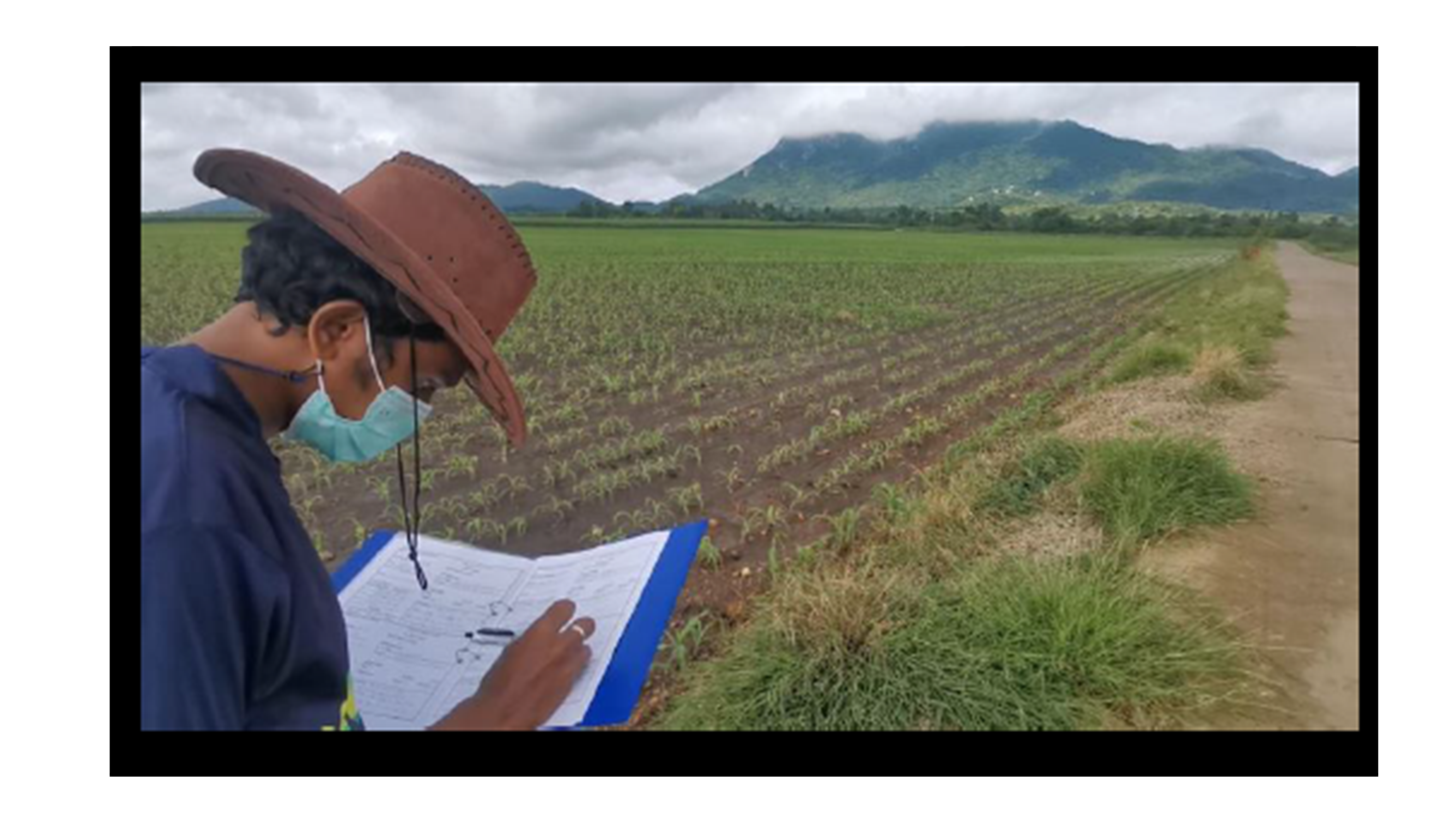
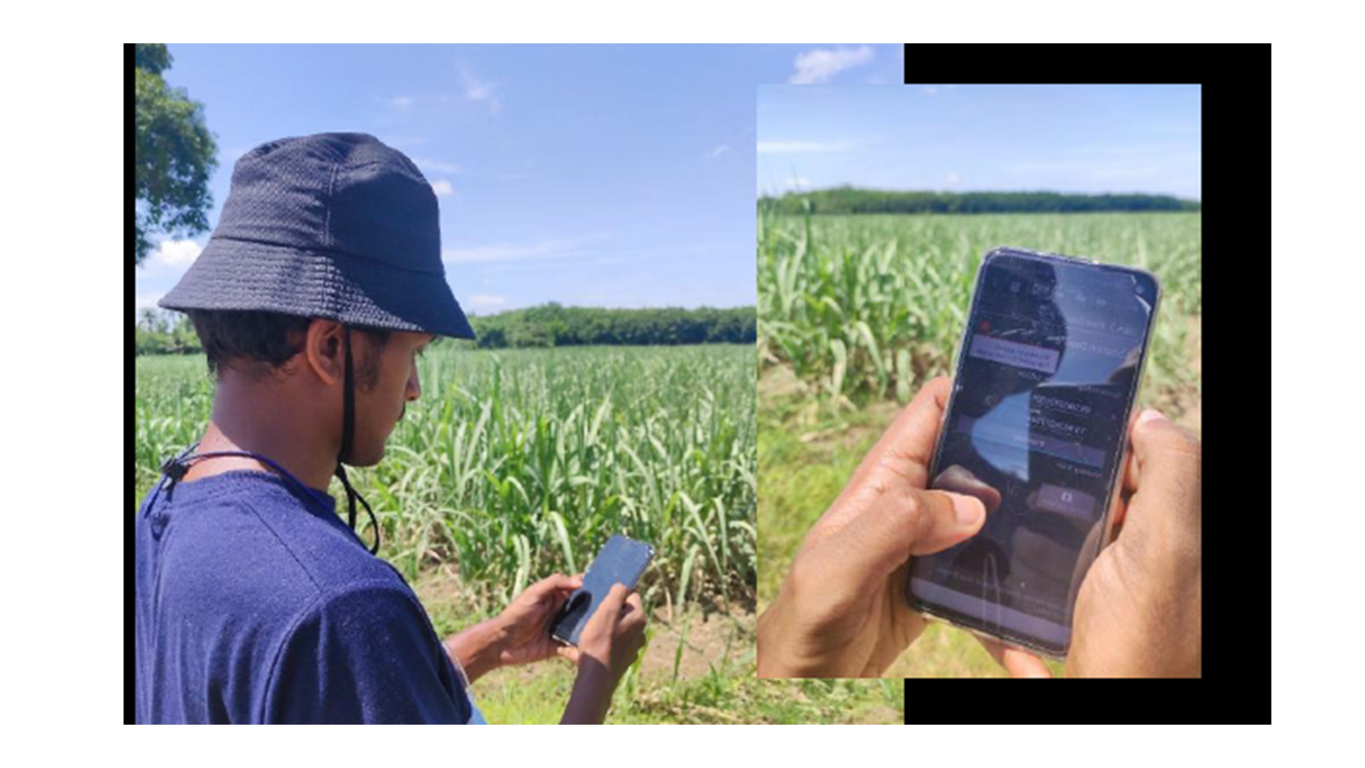
In the development of earth observation (EO) technology, it has been widely used and implementing the insights on the agricultural context in delivering the information related in the coverage area. In this project, we used the remote sensing concept actualise with the ground truth data collection for the approaches to minimize laborious work and increase the efficiency of data collection capacity.
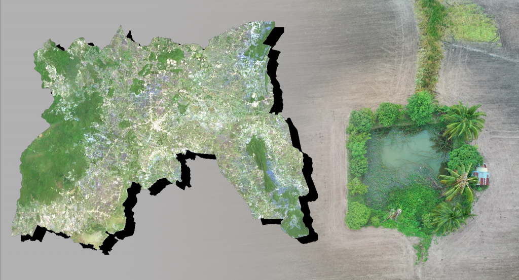
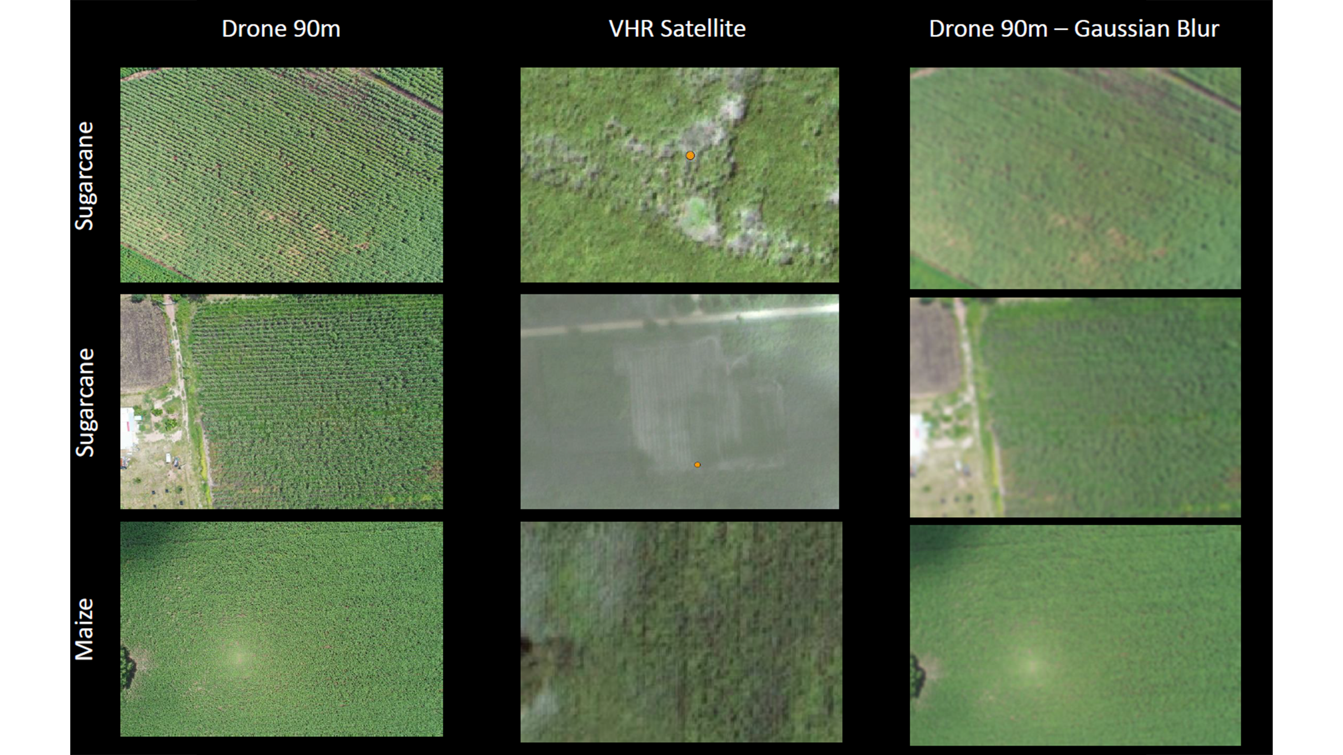
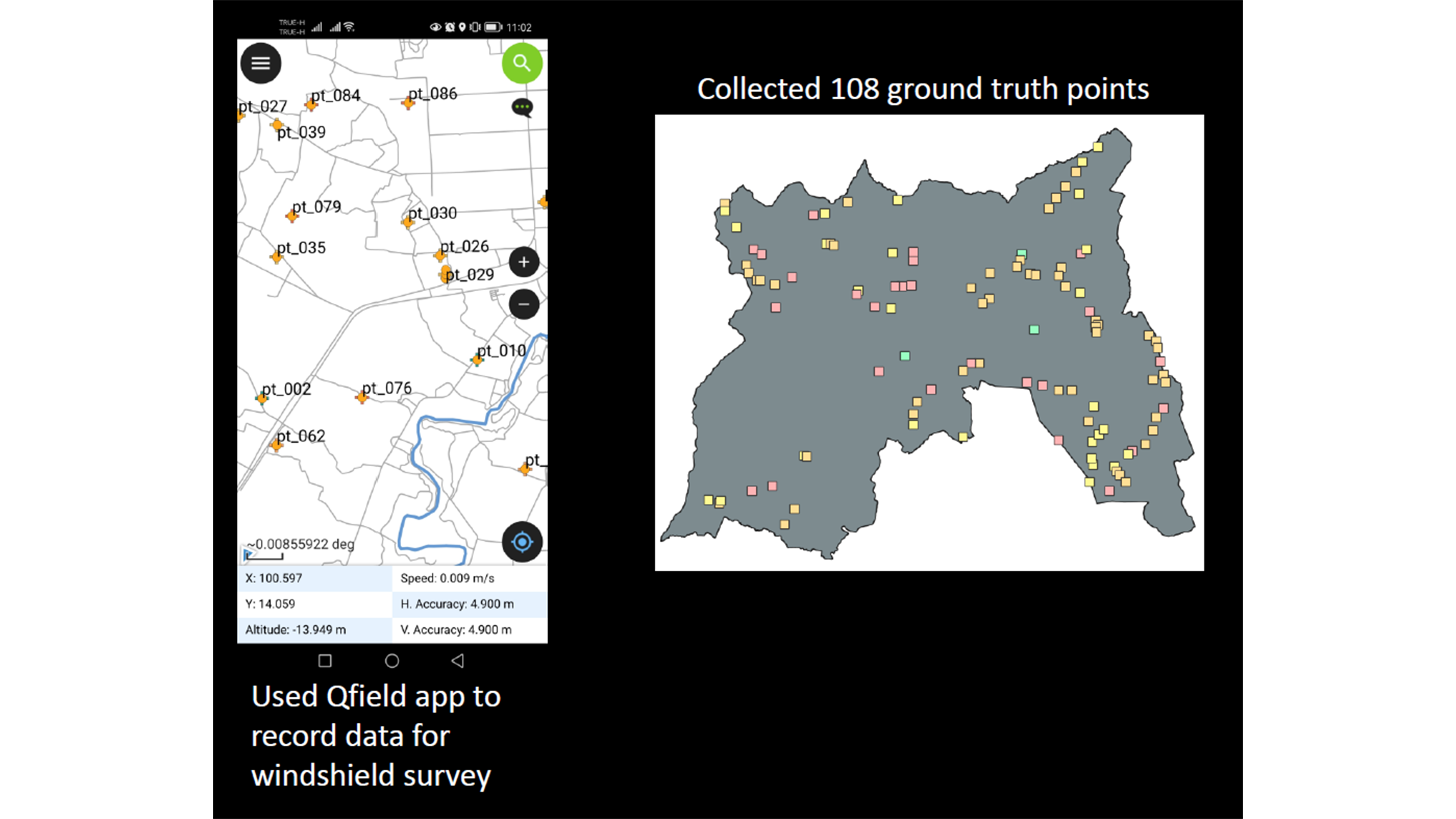
This project elaborated the investigation of the current technologies that can benefit ground truth data collection in agricultural context. The current technologies are implying to mobile applications for recording the ground truth data, unmanned aerial vehicle (UAV). The choices of the technologies are based on the condition of the study area: remote access and inaccessible data collection sites. We utilized the high-resolution satellite imagery to comply with the land use identification in the area.
UAV can provide the information within images and tool 15% of in-situ data collection from one district. The information derived for different types of agricultural products such as sugarcane and maize. The project is closely elaborated with the local statisticians in Southeast Asian countries and deliver capacity building trainings.