
Area : Nepal
Client : JAXA
Start Year : April 2011
End Year : March 2012
Partners : –

Estimation of Above Ground Forest Biomass in a Tiger Habitat of Western Nepal using ALOS Data and Field Inventory
The objectives of the project were: 1) To develop a biomass model based on the relationship between the RADAR backscatter coefficient and the AGB calculated from the field data, 2) To derive a biomass map of the study area, 3) To estimate tree height from the ALOS/PRISM-derived DSM.
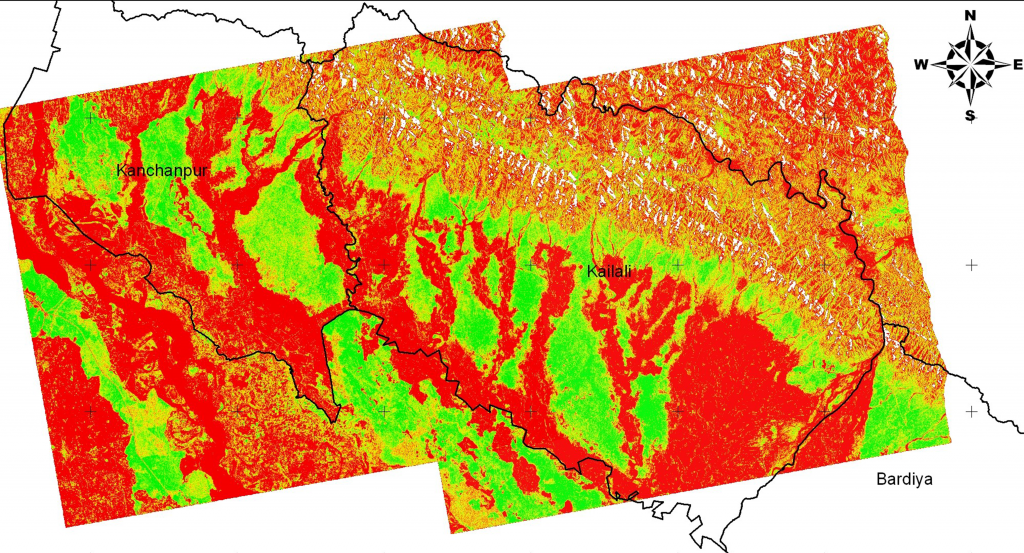
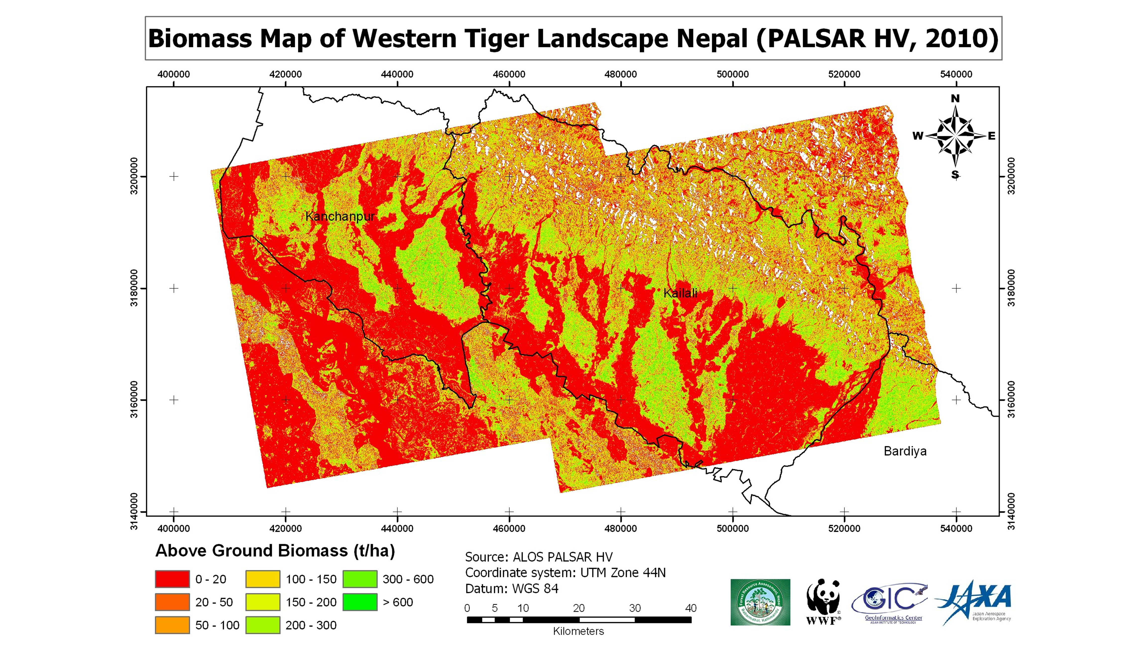
The ALOS/PALSAR data were processed to derive the backscatter coefficient in decibel values. The following processing steps included terrain correction, co-registration, radiometric calibration, and adaptive filtering. With the 90m resolution of DEM (Digital Elevation Model) from SRTM (Shuttle Radar Topography Mission), terrain correction was done in ASF MapReady software to reduce the effects of the illuminated target area caused by topography and SAR image geometry. For multi-temporal processing and analysis, co-registration was performed to align the pixel-level images and remove shifts between images on different dates. The relationships between the resulting radar backscatter values and the AGB values from field measurement were analyzed over a grid with a cell size of 9 by 9 pixels (approximately 1 hectare) to match the scale of the regression model. Then, a non-linear regression approach was used to develop a biomass model. Finally, the best-fit biomass model produced a biomass map of the study area. The results successfully made a biomass map; however, like any other similar research using RADAR backscatter coefficient of L-band, it has constraints in terms of biomass saturation at around 100 t/ha.
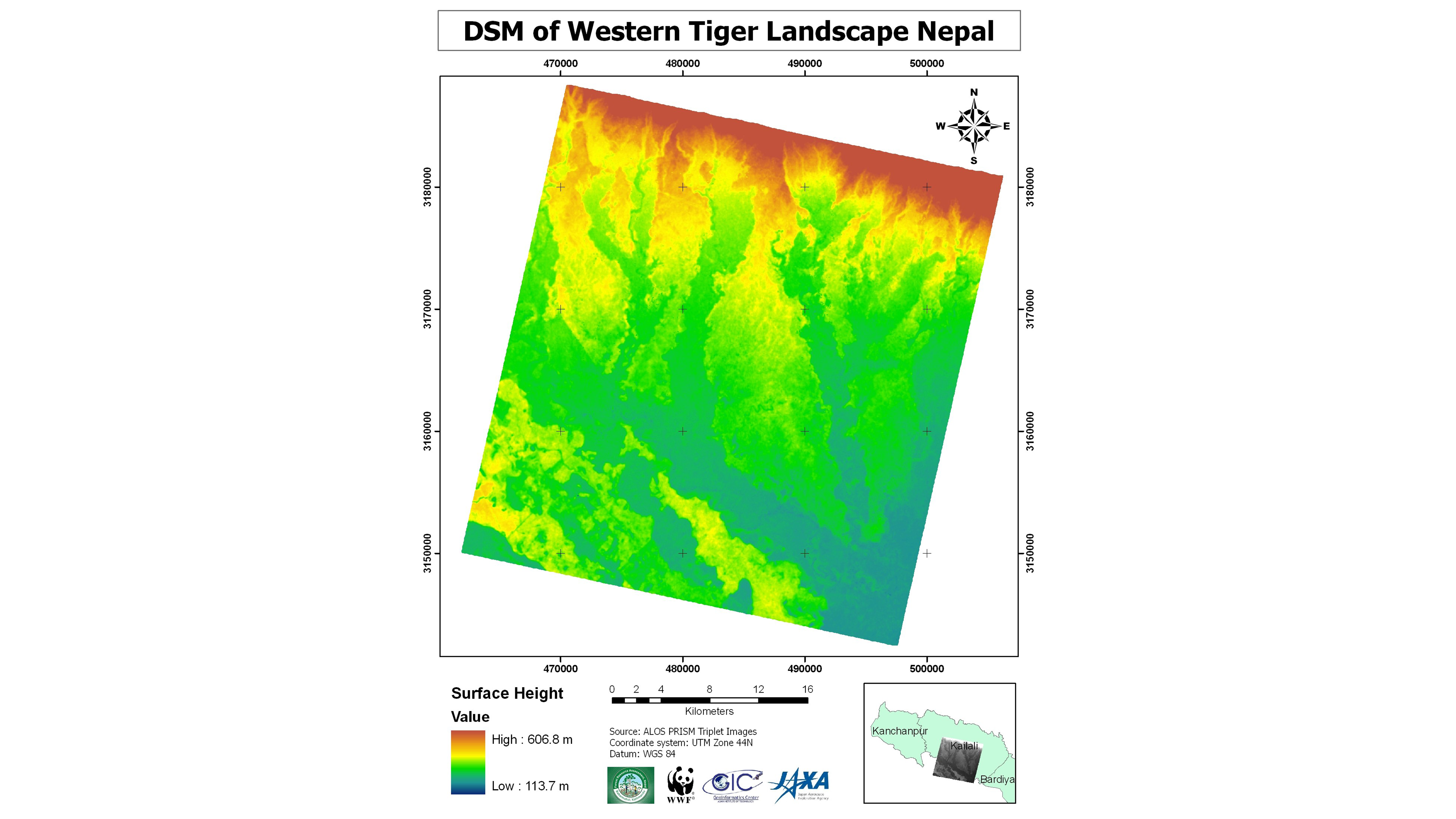
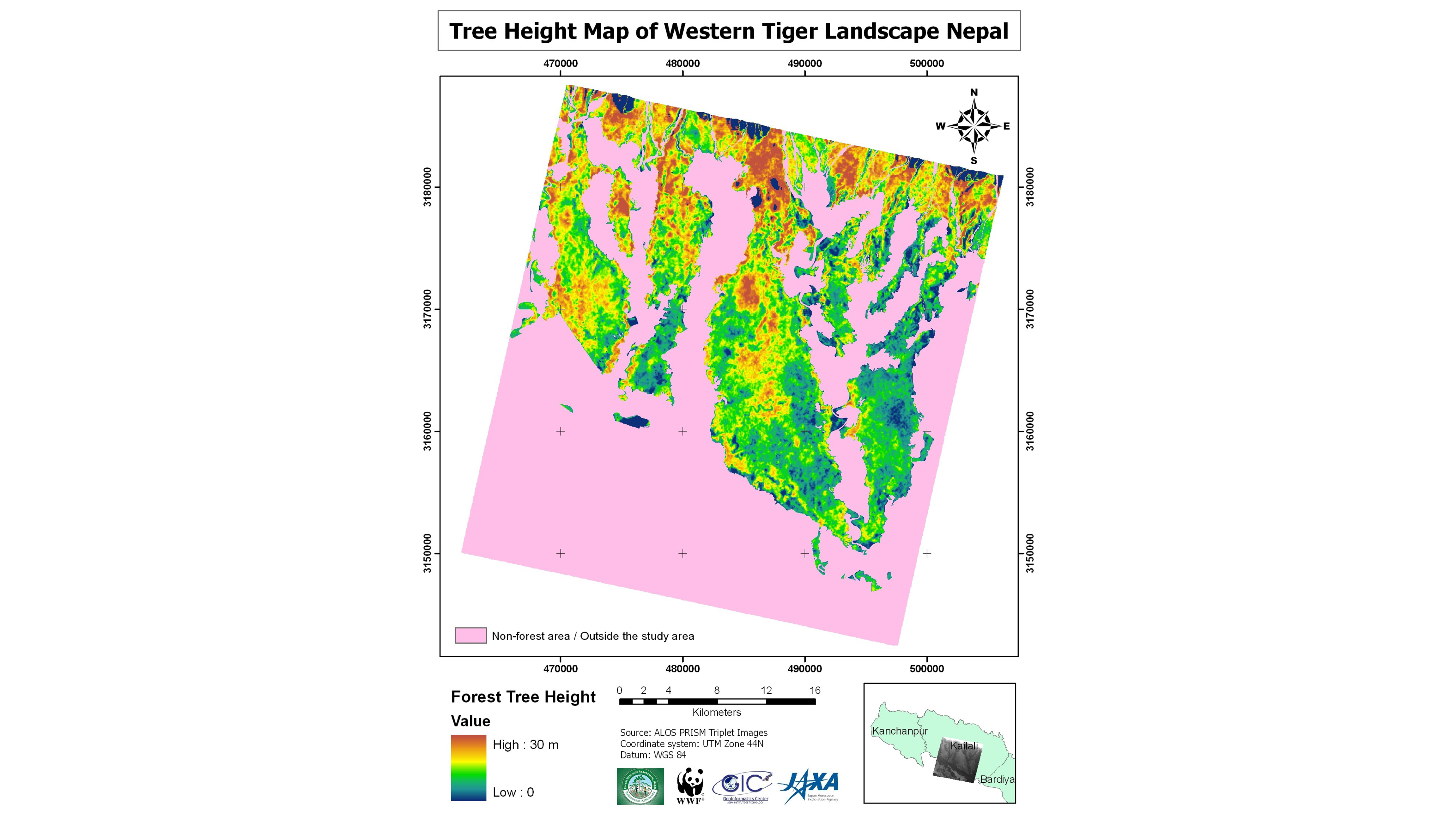
An attempt to extract information on forest tree height from ALOS/PRISM triplet images was made to produce a tree height map. However, an important consideration here would be the vertical as well as horizontal accuracy of the elevations. A profile analysis shows good agreement between elevations derived from ALOS/PRISM and DEM from the Survey department in open areas (approximately within 5m accuracy). Further research is needed to improve the accuracy of incorporating the height information into the biomass model.