
Area : Sri Lanka
Client : JAXA
Start Year : April 2011
End Year : March 2012
Partners : –


Mapping and Change Detection in Mangrove Areas in the North and North-Western Provinces of Sri Lanka Over the Past Five Decades
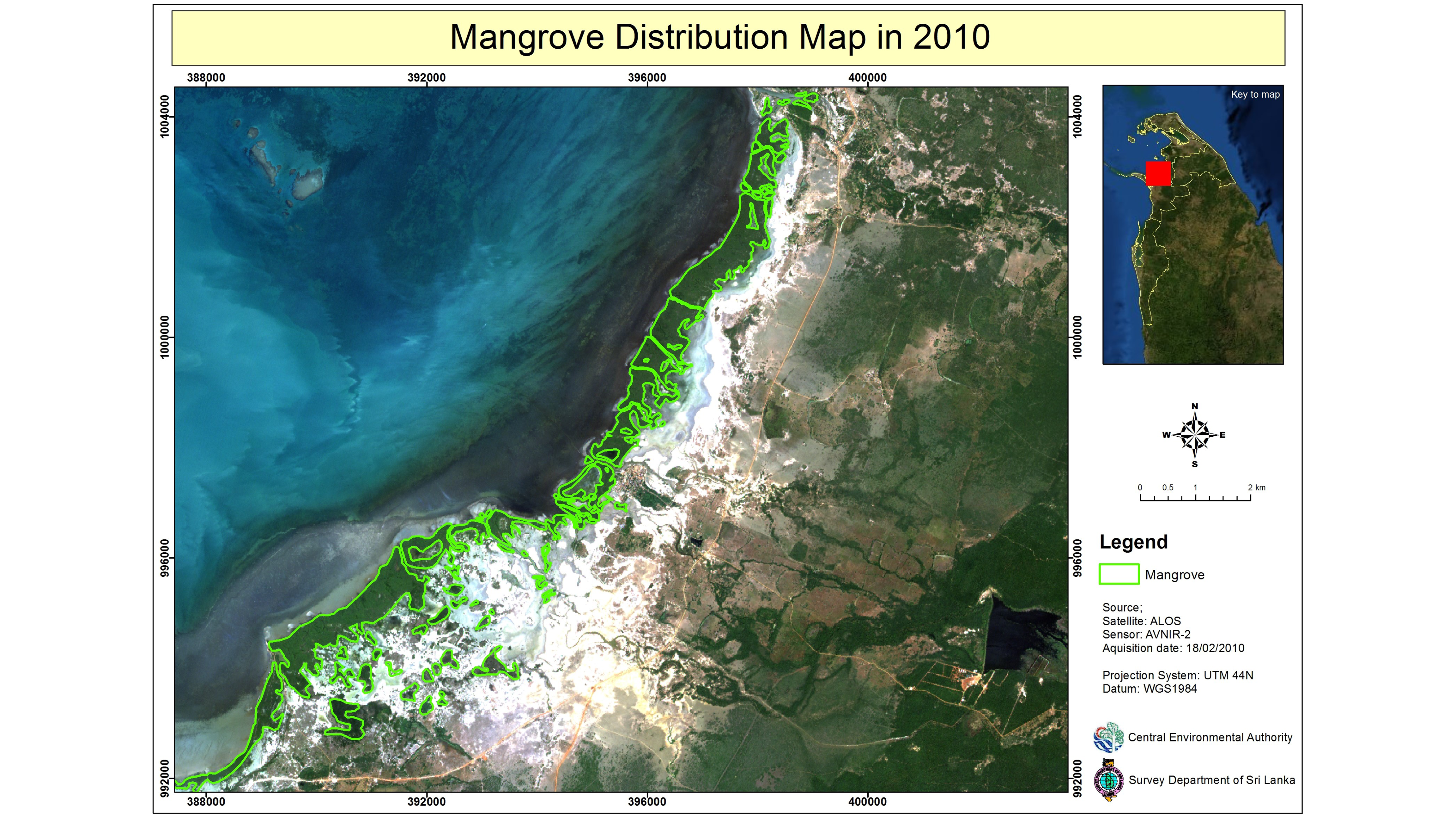
The project’s objectives were: 1) To update the mangrove distribution map using ALOS/AVNIR-2 data of 2010; 2) To identify changes/degradation of mangrove ecosystems in Northwestern and Northern provinces during the past five decades.
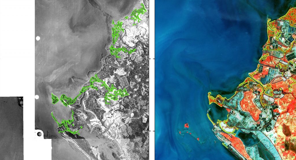
In the Northern and North-Western provinces of Sri Lanka, mangrove forests are degrading due to population pressure and shrimp farming surrounding the lagoons, especially in Mundal Lake and Puttalam lagoon. ALOS/AVNIR-2 images of 2010, Landsat-TM images of 1999 and 2000, and aerial photographs of 1956 were used for mapping and change detection of mangroves in the study area. Pixel-based, unsupervised, and supervised classification techniques were used for identifying the land use and landcover classes, including the mangroves. Separating mangroves from other forest types was difficult due to similar responses in the spectral domain. Ground-truth verification with geo-tagged photos was carried out to facilitate the supervised classification. ALOS/PALSAR FBD dual polarization images were also used to generate RGB color composite images with HH, HV, and HH/HV combination of forest/non-forest classification. Results from multi-temporal satellite data analysis showed significant changes in mangrove areas during the study period. The degraded and stable mangrove areas were identified during the study period from 1956 to 2010.