
Area : Malaysia
Client : JAXA
Start Year : April 2011
End Year : March 2012
Partners : –
Landuse and Landcover Change Detection and Wetland Biomass Estimation in Klias Peninsula of Malaysia using Remote Sensing and GIS
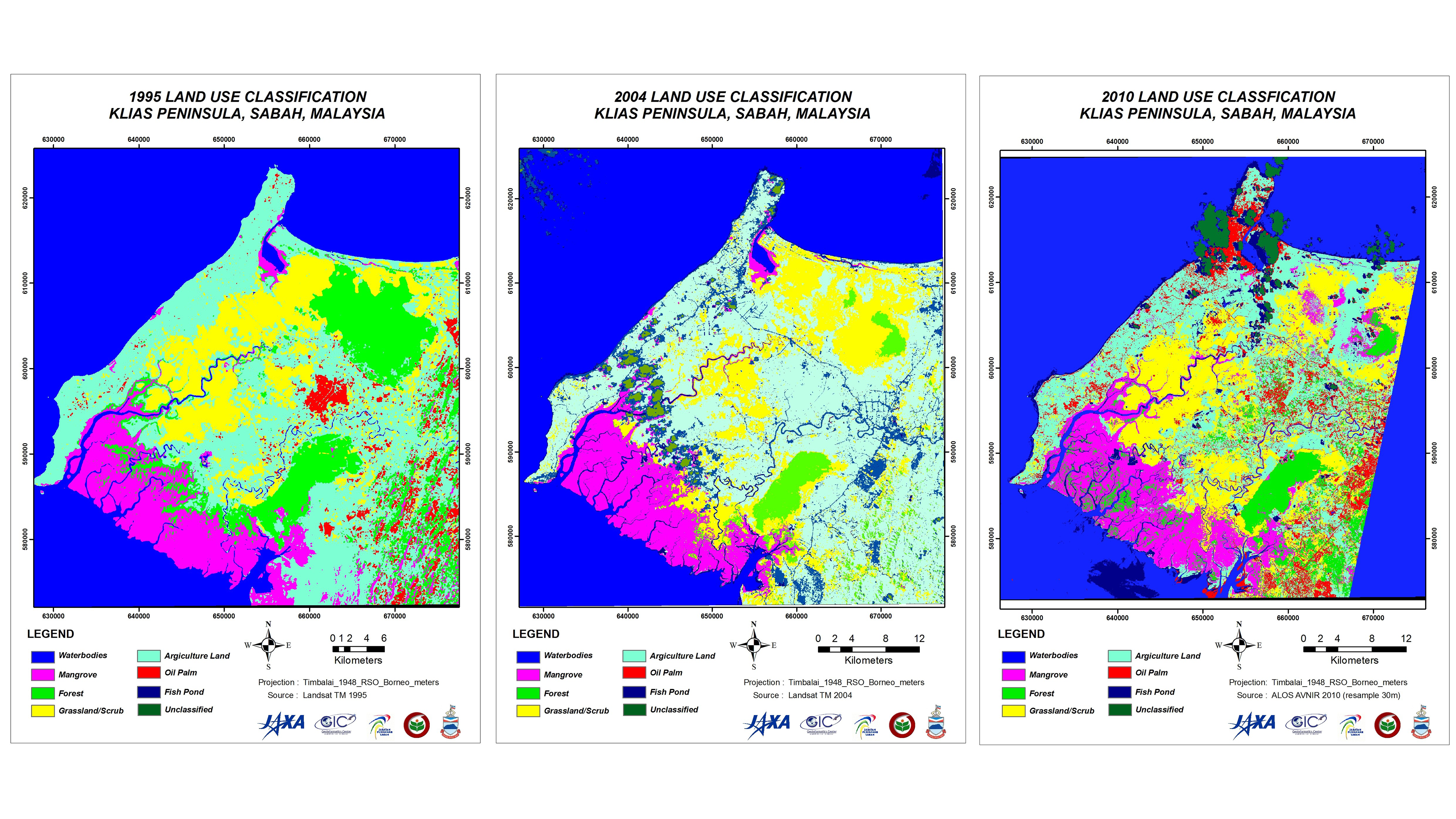
The objectives of this project were: 1) To update the current land use and land cover map of the study area, 2) To identify and map the changes in the mangrove forests, 3) To estimate the biomass of the current mangrove forest in Klias Peninsula using ALOS/PALSAR data.
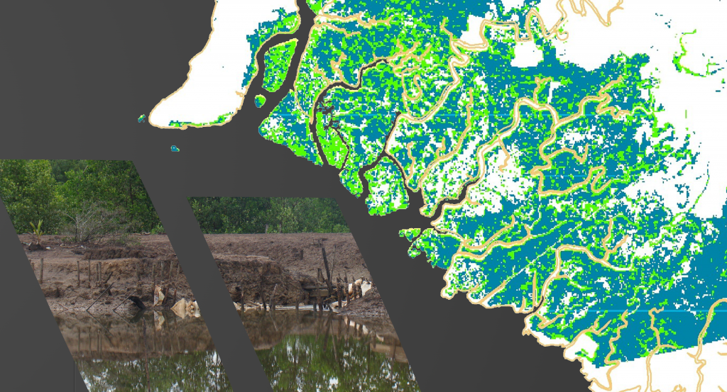
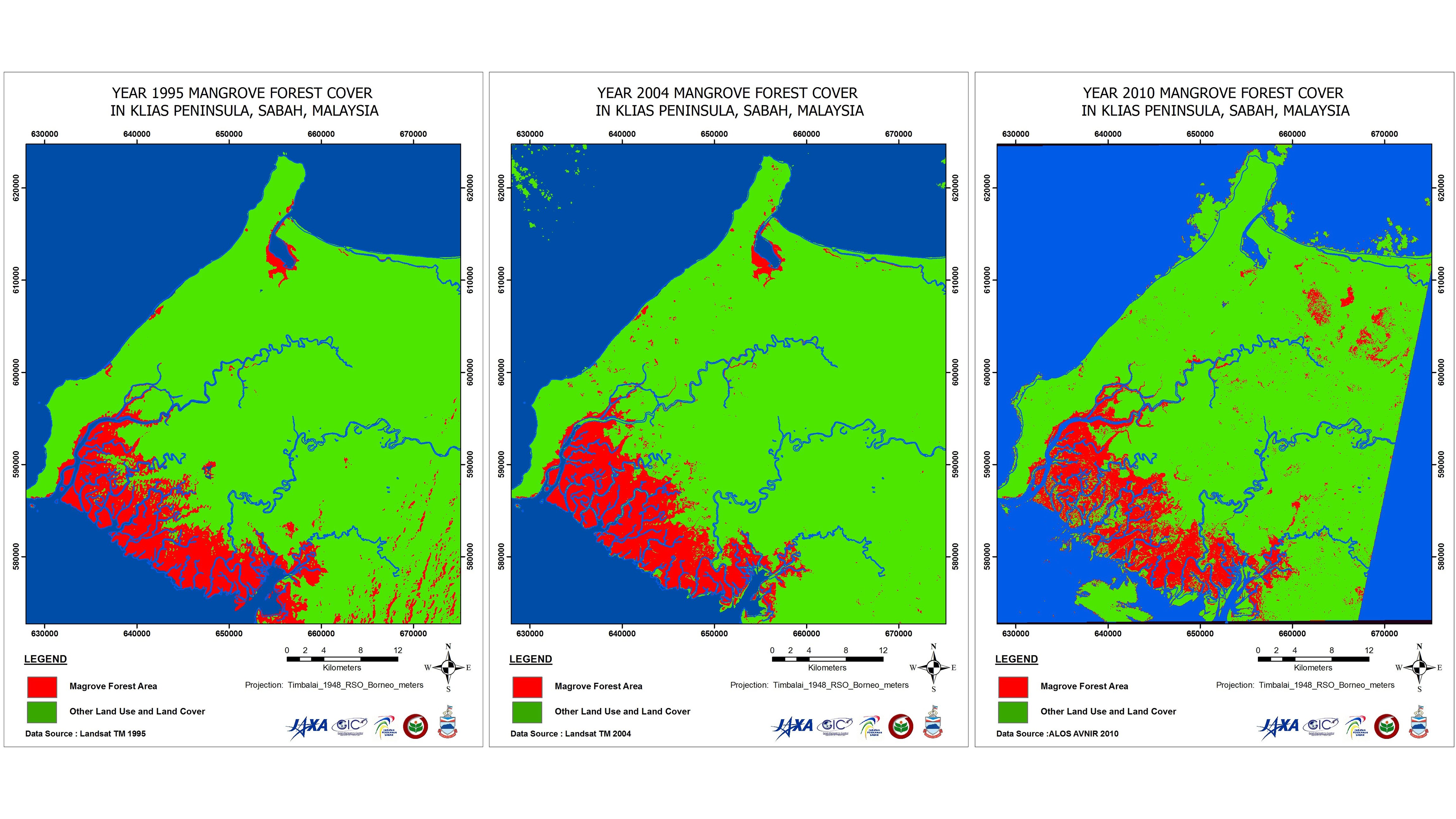
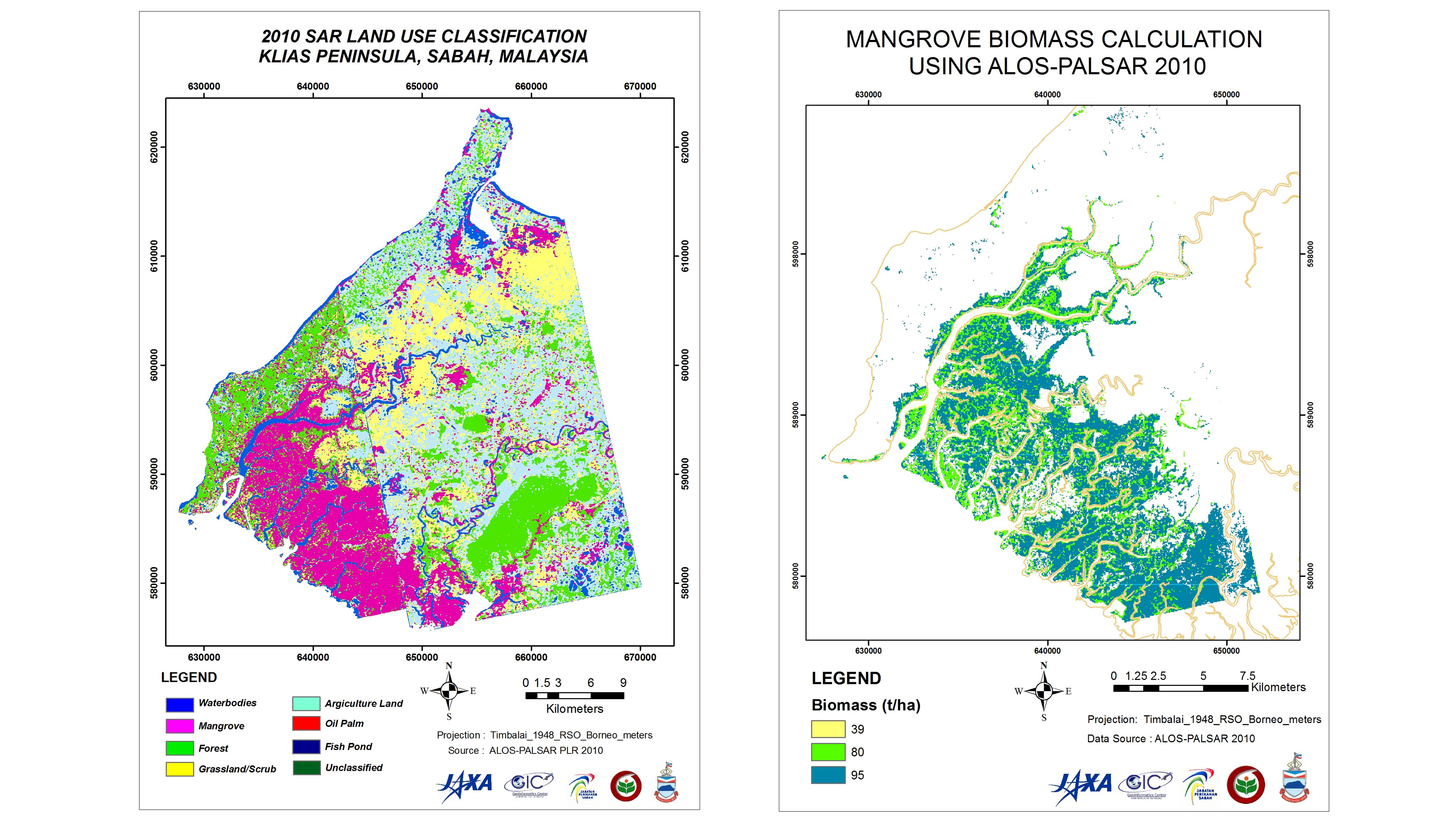
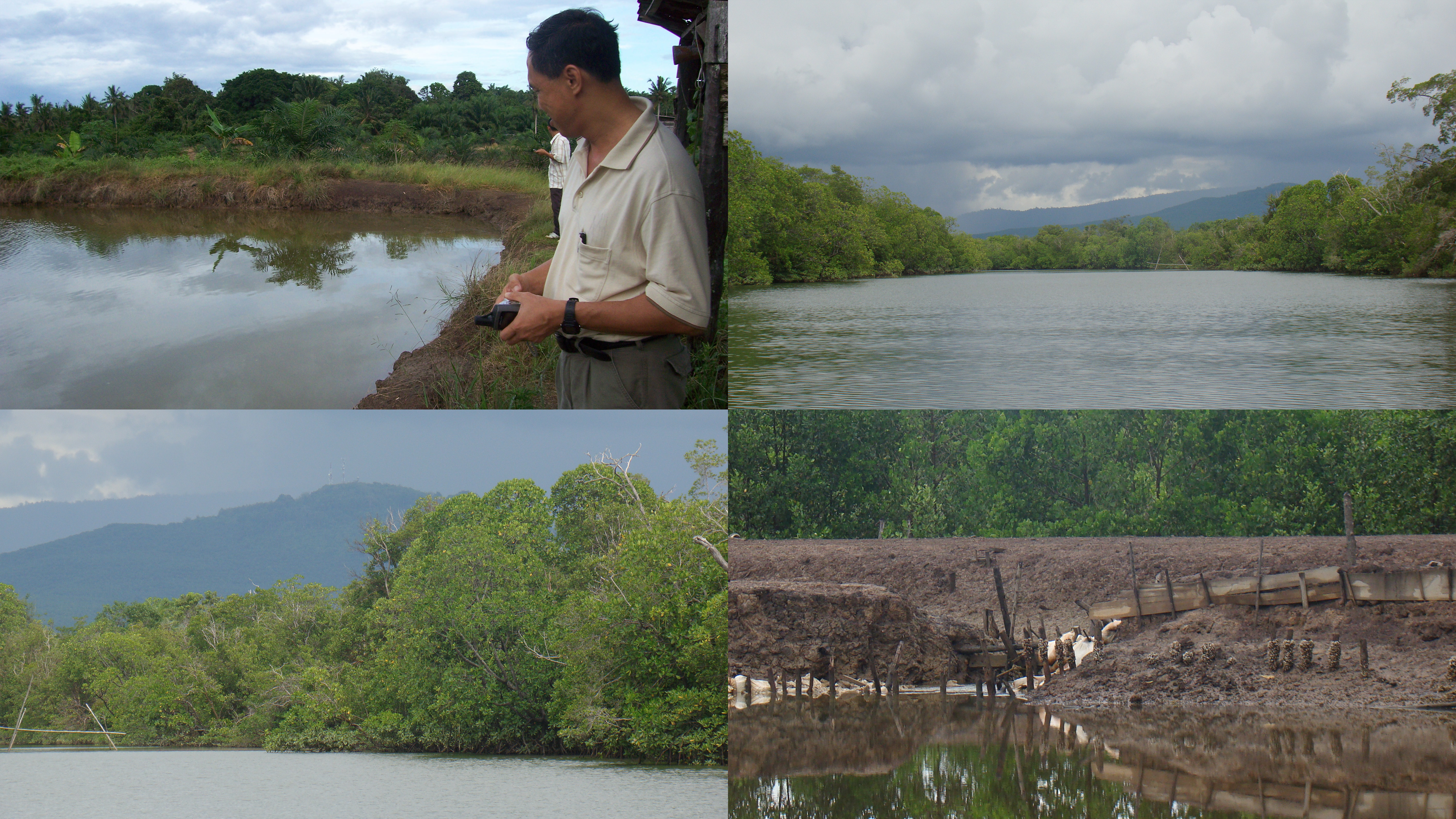
Klias Peninsula is the largest remaining wetland in Sabah, Malaysia. The full Polarimetric ALOS/PALSAR and ALOS/AVNIR-2 of 2010 sensors were used to produce the study area’s most recent landuse and landcover map. ALOS/PALSAR images benefited the study as clouds often cover the area. A combination of field data and past land use and land cover maps were used to carry out the classification. ALOS/PALSAR PLR 1.1 level data was used to apply the Wishart classification algorithm for the SAR data. Optical image classification was carried out using a maximum likelihood algorithm. To improve the accuracy of the classification, the Principal Component Analysis was used for the classification, especially for distinguishing the mangroves from the other forests. LANDSAT-TM images of 1995 and 2004 were also classified to examine the mangrove forest change. It was found that the mangrove forest area declined from 1995 to 2010 but started to increase in 2004, mainly due to the forest department’s mangrove re-plantation campaigns. The biomass estimation of the mangrove forest was obtained using a relationship between the mangrove forest biomass and the SAR backscatter coefficient.