Dynamics of Shifting Cultivation using Socio-economic Data in Lao PDR
Area : Lao PDR Client : JAXA Start Year : April 2011 End Year : March 2012 Partners : –
Studying the Dynamics of Shifting Cultivation in Kasi District of Lao PDR using Satellite Images and Socio-economic Data
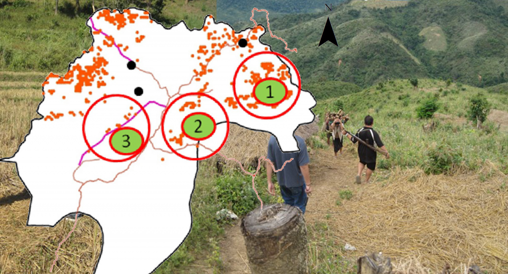
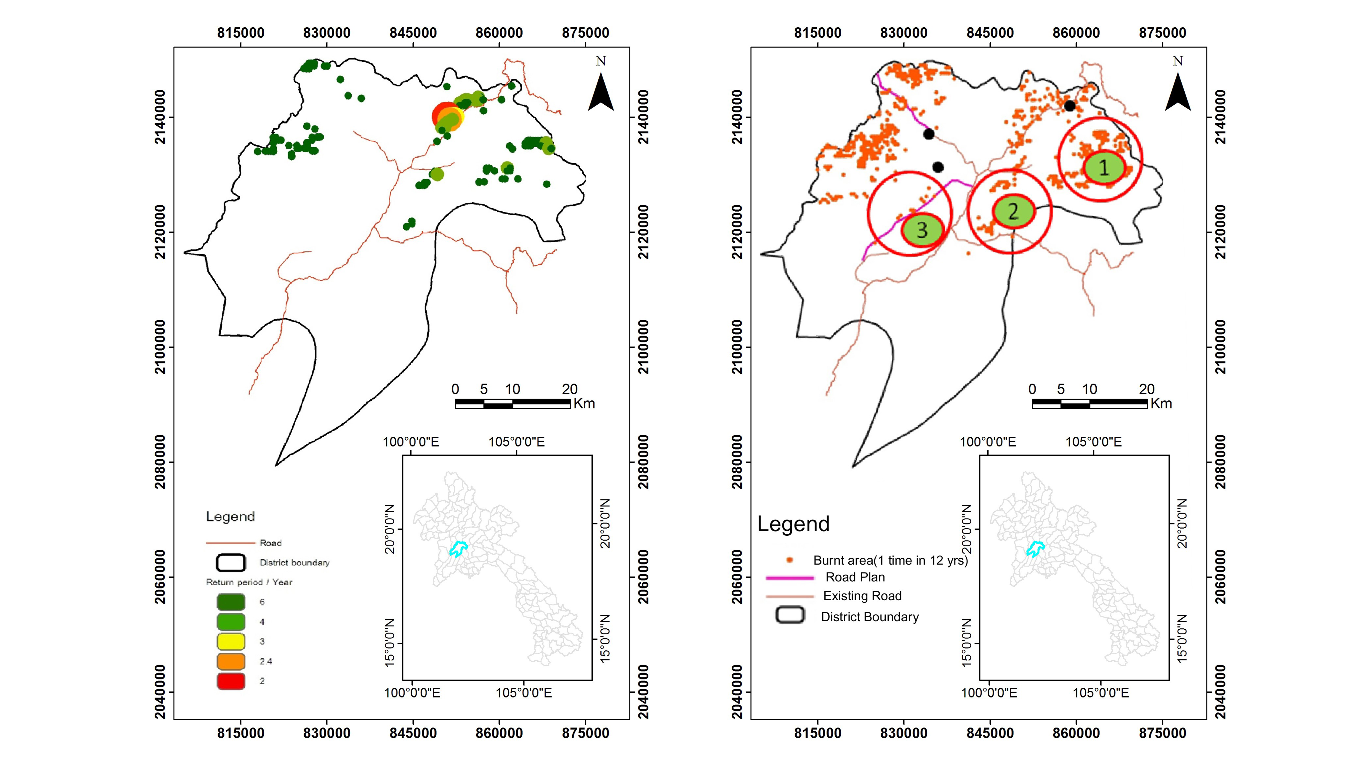
The objectives of this project were: 1) To detect shifting cultivation hotspots using MODIS burned area products, 2) To analyze the contribution of physical, biological, and socioeconomic factors to shifting cultivation.
Shifting cultivation in Lao PDR is a common practice in upland involving more than 150,000 households, approximately 25% of the rural population. As slash and burn is a common practice for land preparation for shifting cultivations, the detection of burned areas is very useful for identifying and verifying shifting cultivation plots. Based on MODIS burned area products, annual burned areas from 2000 to 2010 were examined. Time series analysis of MODIS products helped identify more frequently burned areas, which are shifting cultivation hot spots, and a very good correlation was found when compared with field data. Overlaying shifting cultivation areas on the land use map showed that shrubs and grasslands are the major land use for shifting cultivation, covering 50% and 40% of total shifting cultivation areas, respectively. Besides, socio-economic factors such as the presence of certain ethnic groups, accessibility, and availability of arable land were identified as the significant factors contributing to shifting cultivations.