In recent years, satellite imagery, drone imagery and CCTV cameras have become increasingly ubiquitous and accessible, providing valuable data for a wide range of applications, from monitoring natural disasters to agriculture monitoring, environmental monitoring, etc. However, analysing this data can be time-consuming and resource-intensive, requiring human experts to manually process and interpret large volumes of visual information. Deep learning, a subfield of artificial intelligence, offers a promising solution to this challenge by enabling automated image recognition and analysis.
The Geoinformatics Center (GIC) at the Asian Institute of Technology has been at the forefront of mapping and analysing the Earth’s surface from satellite images and drones for many years.
We have a wealth of experience and expertise in this field and have worked on numerous projects for a variety of clients. However, with the recent advancements in deep learning technology, we have recognized the potential to take our mapping capabilities to the next level. By combining our experience of mapping and remote sensing with the power of deep learning algorithms, we can now analyse satellite images, CCTV images and drone data with greater speed, accuracy, and efficiency than ever before.
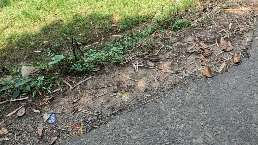
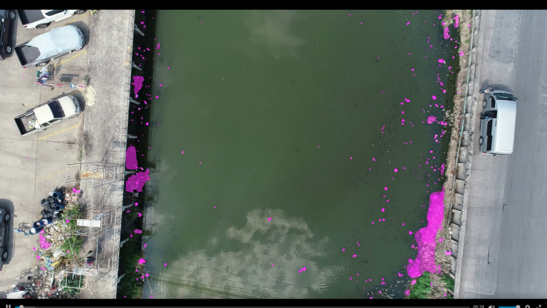
One such recent successful project was about monitoring plastic litter in rivers and roads using deep learning with the financial support from UN Environment Program (UNEP) and with technicaladvisory support from the Google. Littering is a significant environmental problem that affectsecosystems, wildlife, and human health. Litter that enters rivers and roads can be particularly harmful, causing pollution and hazards to both aquatic and terrestrial organisms. Traditionalmethods of litter detection and collection are often time-consuming and labor-intensive, requiring human inspectors to manually search for litter. Under this project, the Geoinformatics Center (GIC) developed AI/deep learning techniques for assessing plastic leakage into the Mekong River using data acquired through various camaras, enabling real time analytics.