Tsunami hazard assessment of Cilacap
Descriptions
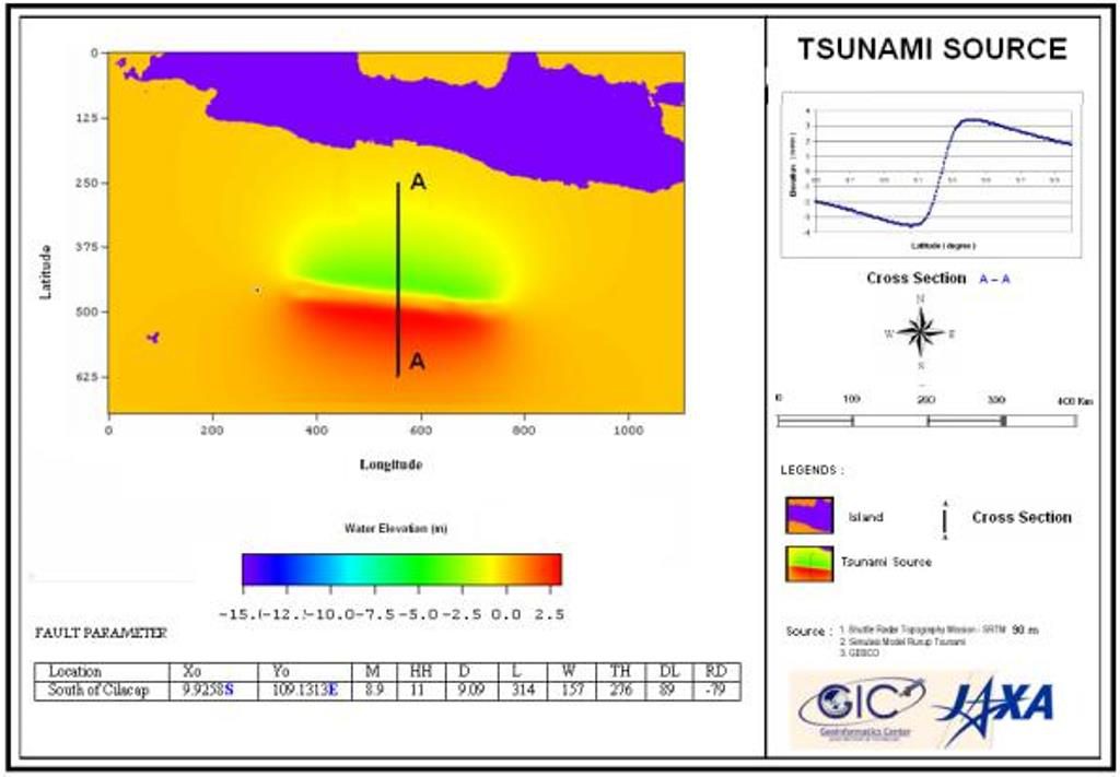
The objectives of this project was to prepare a Tsunami Hazard map for Cilacap area, Central Java which has a great threat from tsunami in future as it falls in a highly active tectonic zone. Tsunami hazard map was prepared by using the TUNAMI-N2 model, developed by Tohoku University, Japan.
The major input parameters for the model were earthquake source parameters, topography and bathymetry information. Digital Elevation Models (DEM) was derived from Shuttle Radar Topographic Mission SRTM and high-resolution ALOS/PRISM data were used for tsunami inundation modeling. The accuracy assessment of SRTM and ALOS DEM with respect to Differential GPS (DGPS) surveyed ground control points shows ALOS DEM has high correlation with the observed values at the ground in comparison to SRTM DEM. The model was simulated for earthquake of magnitudes of 7.7, 8.2 and 8.9 MW and source parameters were estimated using Emile Okal solution. The results showed that for the worst-case scenario, an area of 16.5 km2 will be inundated based on SRTM 90m DEM whereas using ALOS/PRISM DEM, it was found that an area of 12 km2 will be inundated. SRTM DEM yields high inundation extent compared to ALOS DEM as SRTM shows low elevation compared to observed ground values in some parts of the coastal areas. It was concluded that improvement in accuracy of DEM reflects in improvement in tsunami inundation and run-up results for preparing an improved tsunami hazard map. Vulnerability analysis was carried out to find the landuse classes and villages exposed to tsunami. ALOS/AVNIR-2 data were used to create landuse map of the study area.

