Use of ALOS Dataset for DEM Generation, Extraction of Buildings and Hydrological Feature
Descriptions
The objectives of this project were: 1) To generate DEM from ALOS/PRISM and assess its accuracy, 2) To classify hydrological features by using ALOS data, 3) To extract buildings from ALOS/PRISM and assess its accuracy.
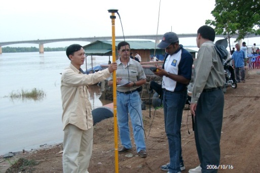
The study area of this project was Kampong Cham province and parts of Prey Veng and Kandal provinces. The DEM of the study area was generated from ALOS/PRISM data using photogrammetric technique with an acceptable output pixel size of 10 m. The height accuracy result was compared with existing elevation derived from ortho-photo and spot heights collected from field survey using a differential GPS (DGPS). The ALOS DEM shows RMS error of 3.08 meters while compared with the field survey data, whereas the RMS error for the ortho-photo was 1.37 meters. Further, the ALOS DEM was used to delineate stream network. This stream network was compared with the stream network prepared from the ortho-photo for accuracy checking. Other water bodies in the study area were classified by using a single band with threshold enhancement technique. The near infrared band was selected for extracting the water bodies and the results were satisfactory. Pan-sharpening technique was used to combine ALOS/PRISM with ASTER data in some parts of the study area for extraction of building shapes. A very good results achieved for the landuse classification map using the pan-sharpened image, however, the building shapes recovered were not very sharp.

