Wildfire Risk Mapping in the Eastern Mongolia using Remote Sensing and Multi Criteria Analysis
Area : Mangolia Client : JAXA Start Year : Apr 2012 End Year : Mar 2013 Partners : –
Wildfire Risk Mapping in Eastern Mongolia using Remote Sensing and Multi-Criteria Analysis
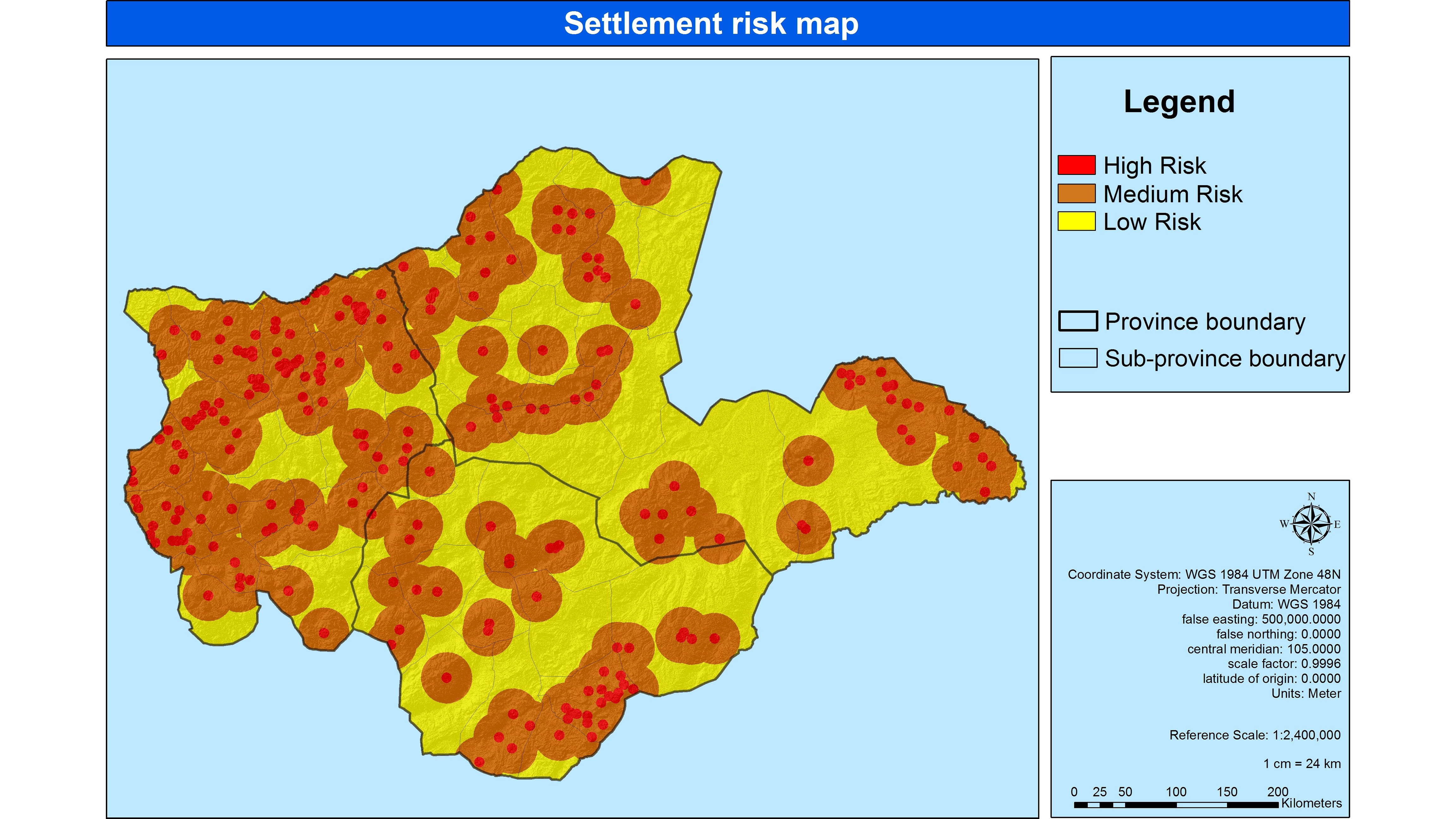
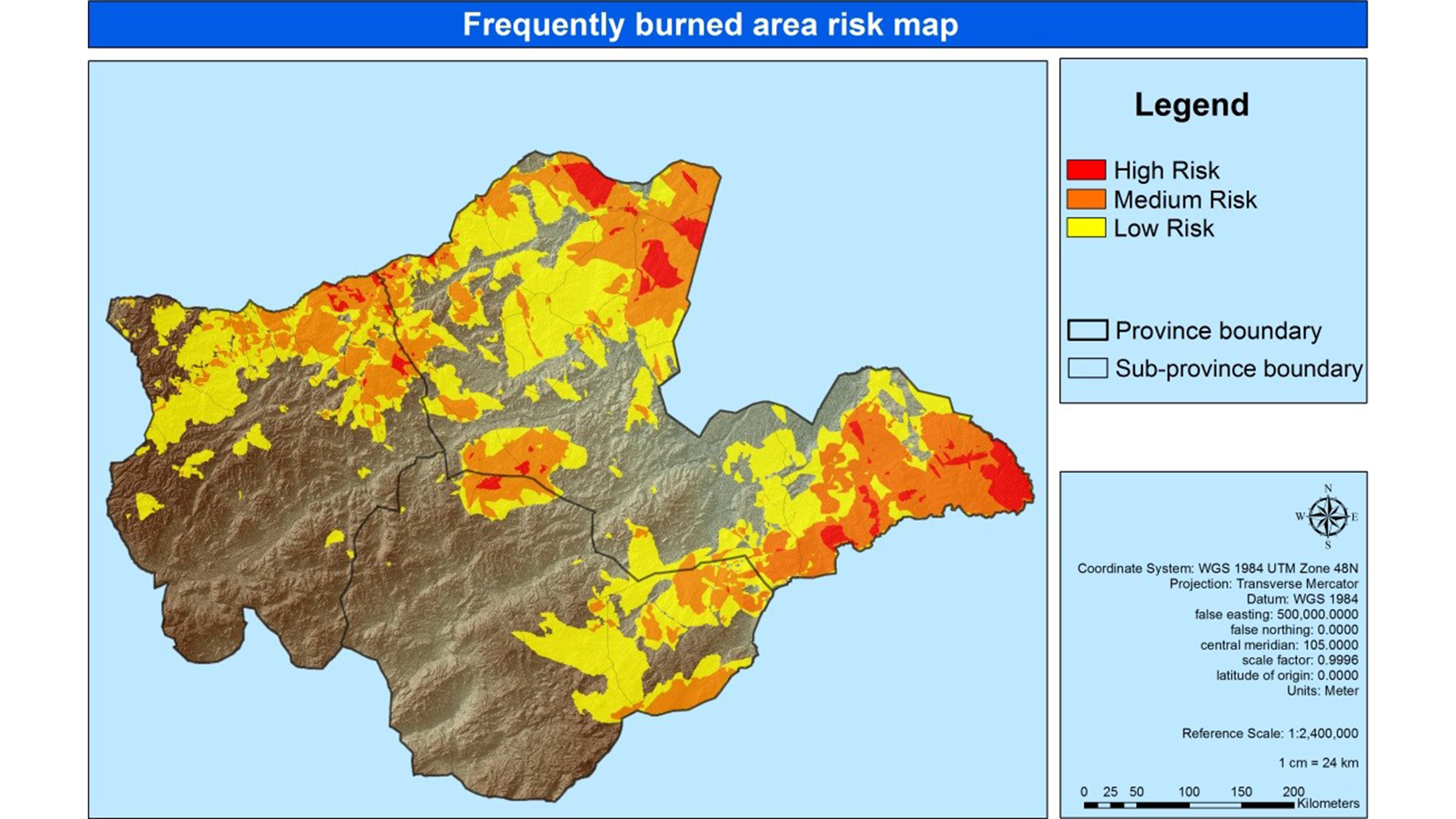
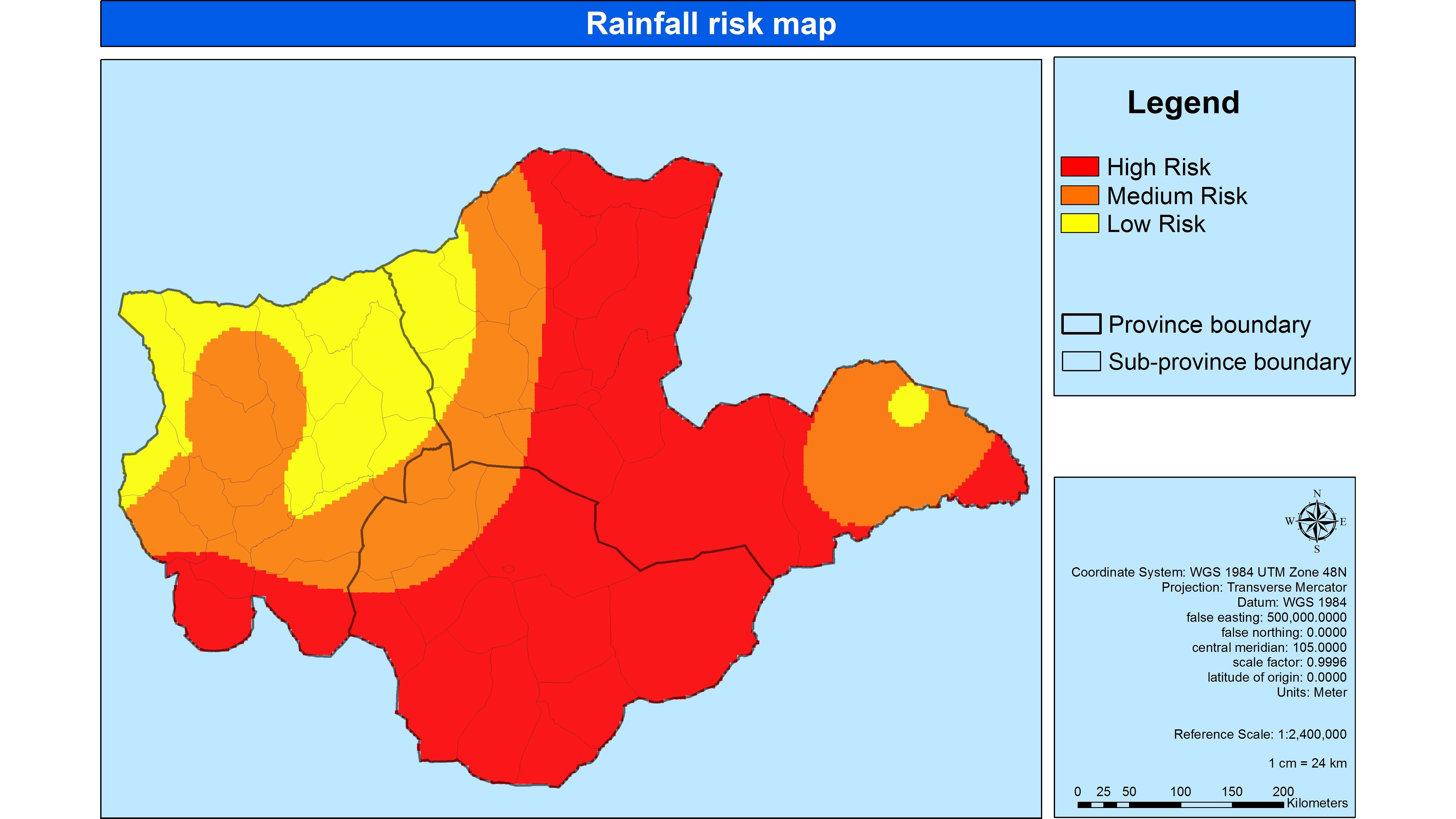
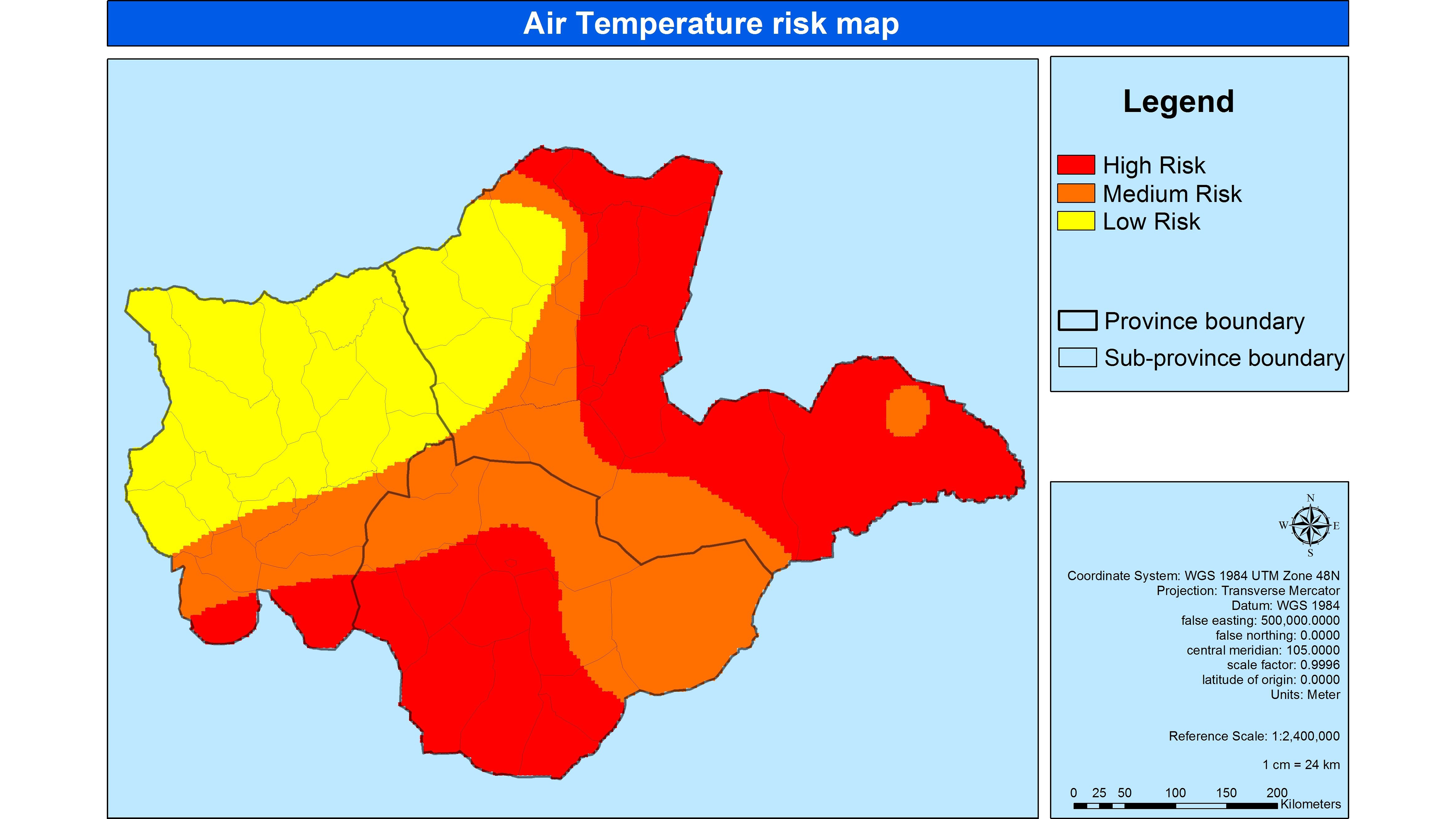
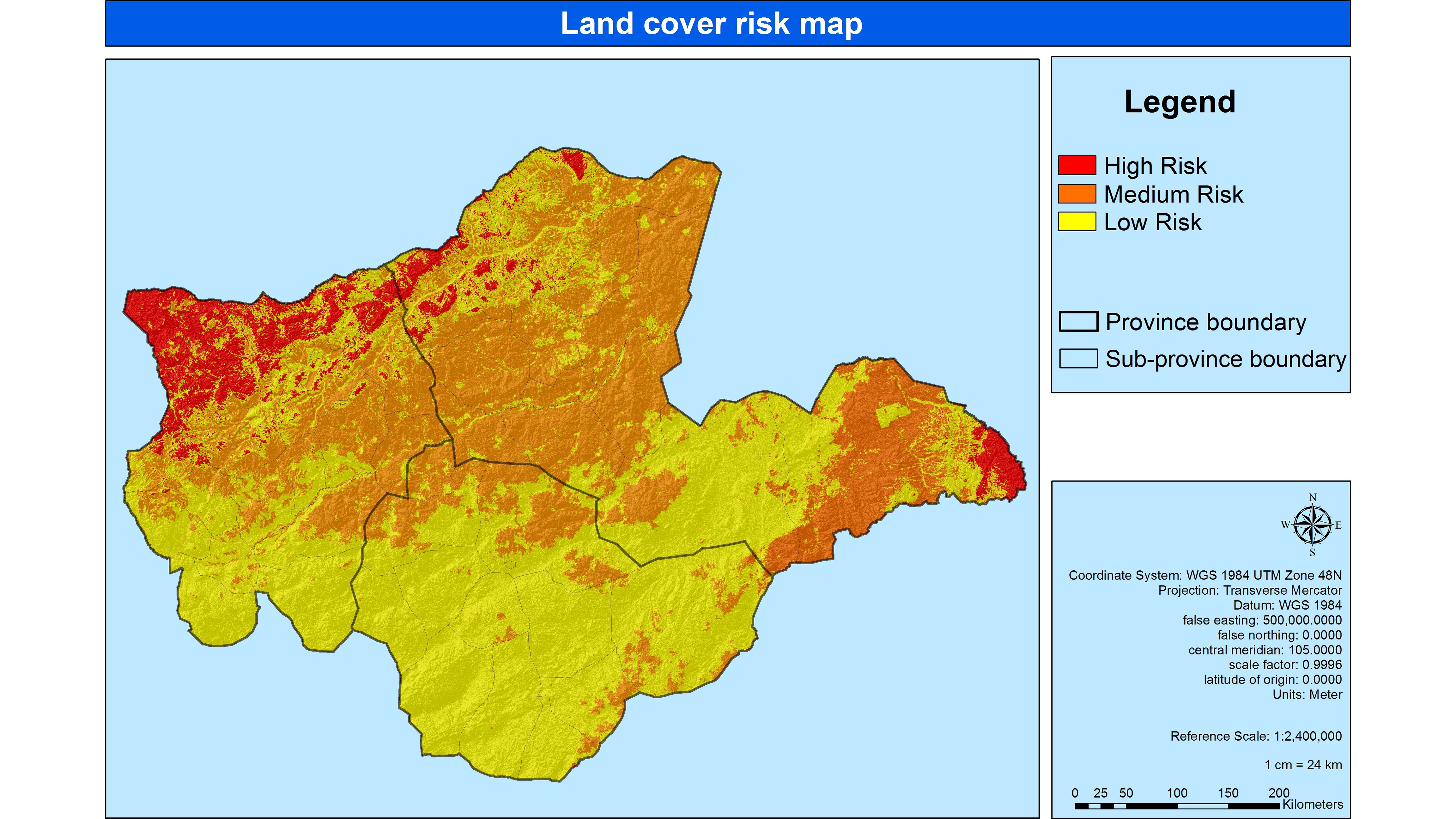
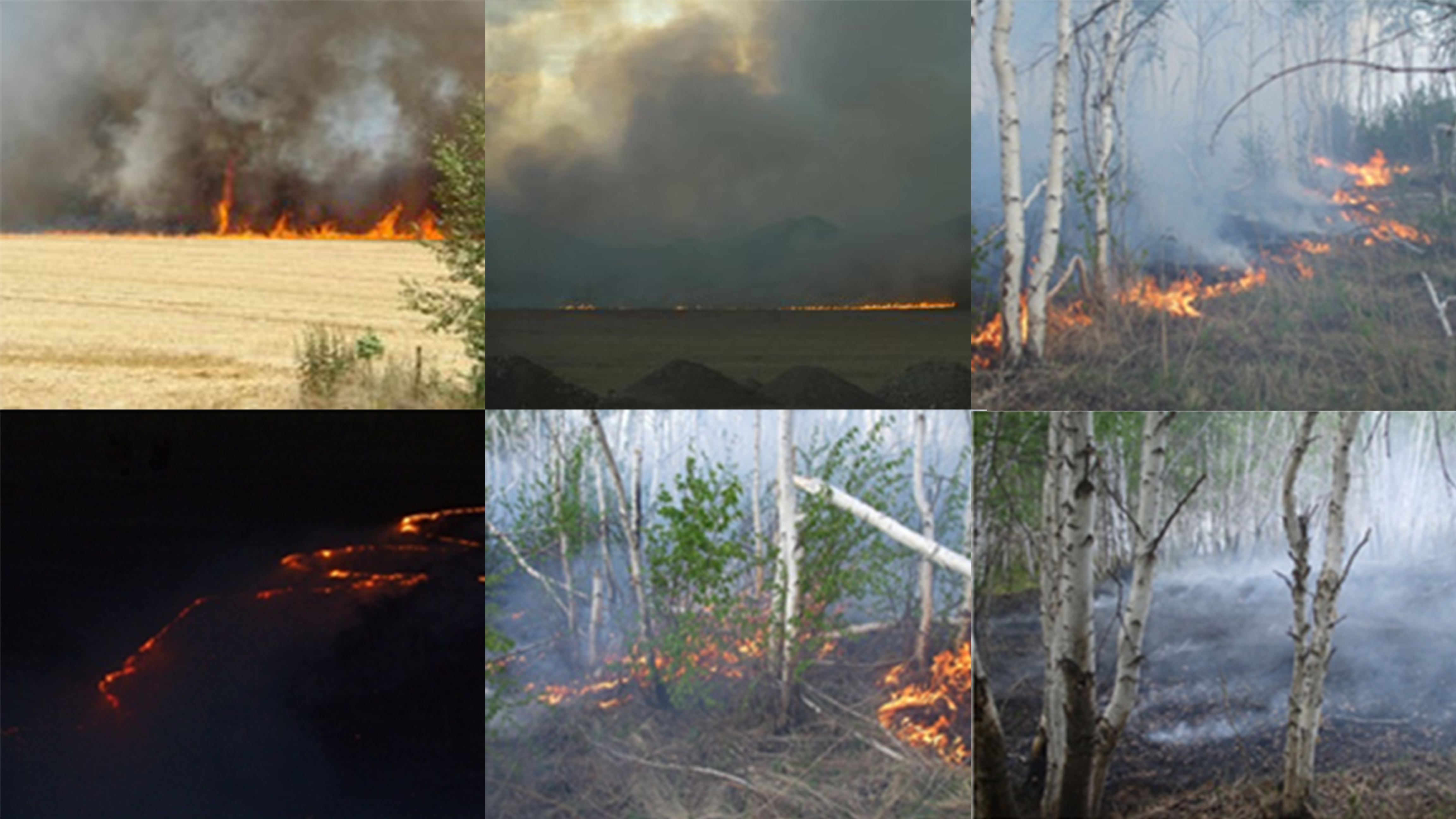
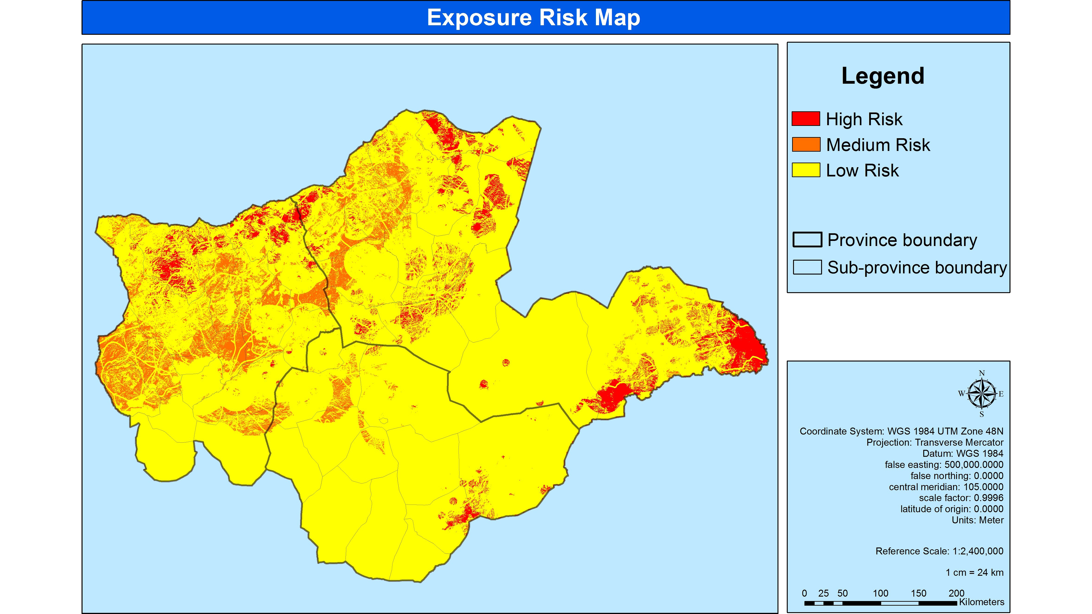
This project aimed at mapping the wildfire risk areas in the Eastern part of the country (especially in the Khentii, Sukhbaatar, and Dornod provinces), where wildfire is one of the most important natural hazards in the country causing significant damage to the environment as well as the country’s economy every year.
The study was carried out by analyzing the natural factors (land cover, slope, aspect, and distance from rivers), climate factors (air temperature and rainfall), fire factors (burned area frequency), and human factors (distance from settlements, distance from roads). The landcover map was obtained from the MODIS landcover map. The slope and aspect maps were derived from NASA’s Global Digital Elevation Model (GDEM). In the past, active fires and burned areas were derived from ALOS/AVNIR-2 and MODIS data available at the National Remote Sensing Agency (NRSC). Climatic and human factors were collected from the data available at the NRSC and other national agencies of Mongolia. The Multi Criteria Analysis (MCA) approach integrated the above-mentioned factors to produce a wildfire risk map by assigning appropriate weights. Results show that 6% of the study area comes under high risk, 4% under medium risk, and 90% under low risk to wildfire.