
Area : Homalin City, Myanmar
Client : JAXA
Start Year : Apr 2012
End Year : Mar 2013
Partners : –


Flood Hazard Mapping in Homalin City in the Chindwin River Basin
The objectives of this project were 1) To develop flood hazard maps for Homalin town for different return periods, 2) To delineate the flood area using the ALOS/PALSAR images, 3) To assess the damage to buildings in the study area through surveys, 4) To estimate the total population affected by floods for different return periods.
Homalin town is situated in the Northwest part of Myanmar in the upper Chindwin River basin, and it experiences heavy rainfall annually. Most of the settlements are located on the banks of the Chindwin River. Therefore, it is necessary to prepare flood hazard maps to draw a strategy for preparedness and mitigation measures.
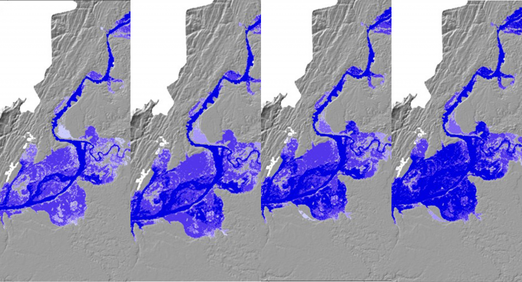
This study produced flood hazard maps for return periods of 10, 50, 100, and 500 years using the annual peak flow data of 44 years from 1968 to 2011. The HEC-RAS model was used for preparing the flood hazard maps. ALOS/AVNIR-2 images were processed to obtain the study area’s most recent land use and landcover information, which was used as an input to the model. ALOS/PALSAR images were used to know the extent of the flood in 2007 and calibrate the flood model. The model results showed that the maximum flood depth was 5.0 meters in 2007. The flood map derived from the ALOS/PALSAR data represented a 10-year flood, which was close to the 2007 flood event.
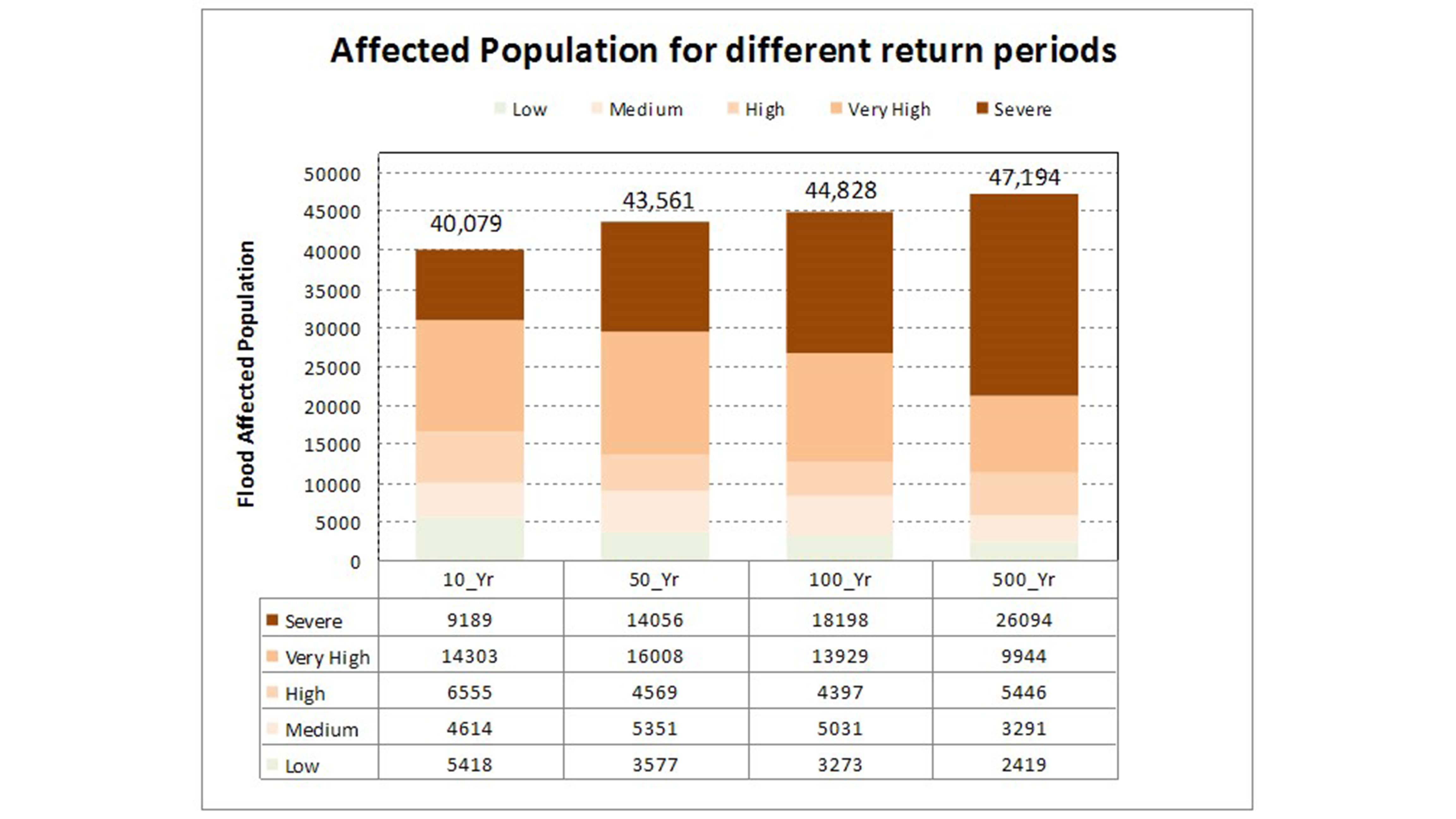
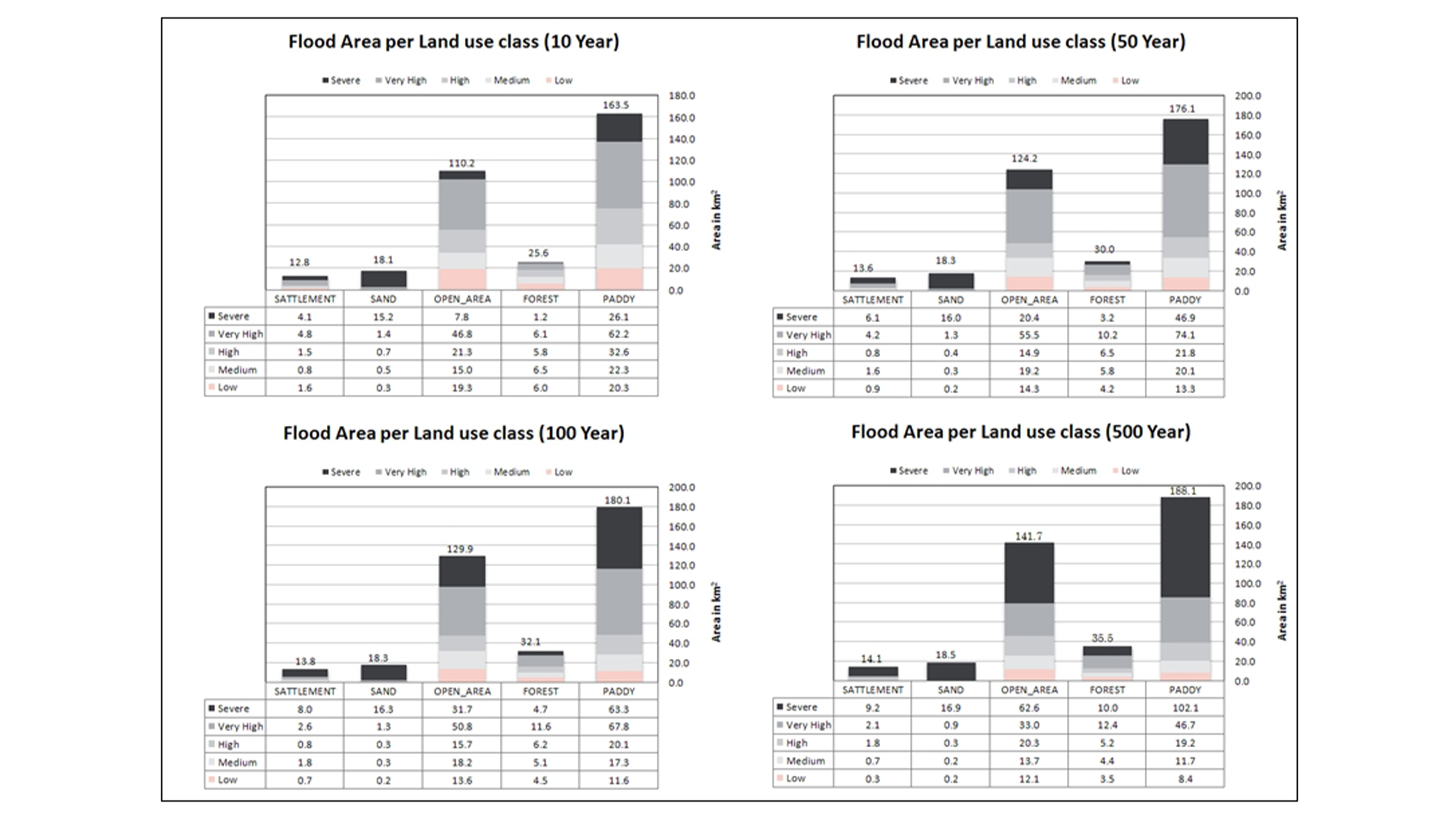
In order to know the population exposed to the floods of various return periods, a population density map was prepared at a 30 m x 30 m pixel size and overlaid with the hazard maps. It was found that a 500-year flood would affect nearly 47,000 residents in the study area. A field survey was conducted to understand the damage caused by floods in recent years, and damage curves were generated from the data collected through the survey. Interviews were conducted among the flood-affected residents in Homalin town to record the damages inflicted by floods. A flood of 500-years return period will inundate an area of 452 km2. This includes paddy fields with damages up to 90 % around the Homalin town.