Strengthening Multi-Hazard Risk Assessment and Early Warning Systems with Applications of Space and Geographic Information Systems in Pacific Island Countries

Project Period: 2016-2018
Countries: Cook Islands, Fiji, Kiribati, Marshall Islands, Micronesia, Nauru, Niue, Palau, Papua New Guinea, Samoa, Solomon Islands, Tonga, Tuvalu, Vanuatu
Client: UNESCAP
Descriptions
The project on Strengthening Multi-Hazard Risk Assessment and Early Warning Systems with Applications of Space and Geographic Information Systems in Pacific Island Countries, focuses to strengthen multi-hazard risk assessment and early warning systems of Pacific Island Countries (PICs) such as Cook Islands, Fiji, Kiribati, Marshall Islands, Micronesia, Nauru, Niue, Palau, Papua New Guinea, Samoa, Solomon Islands, Tonga, Tuvalu, and Vanuatu by enhancing the capacities of responsible institutes via capacity building training programs on space technologies such as Remote Sensing (RS) and Geographical Information Systems (GIS), and by deploying geospatial data sharing platforms for disaster risk management (Geo-DRMs) in the Pacific region.
The Pacific Island Countries are exposed to a variety of disaster risks, such as tsunamis, drought, tropical cyclones, storm surges and coastal zone flooding. Despite these risks, coastal areas continue to attract people and are growing more rapidly than those inland, putting additional people at risk of coastal hazards. In order to build resilience to disasters in these high-risk areas of Pacific Island Countries, multi-hazard risk management and end-to-end early warning systems are essential, as evidenced by the experience of Japan as well as other countries in the Asia-Pacific region.
GIC’s involvement in this project is to strengthen the capacities on applications of Space and Geographic Information Systems in Pacific Island Countries and to develop and deploy geo-spatial data sharing web based platforms for disaster risk reduction (Geo-DRMs) in the Pacific countries. More specifically, the expected outputs by GIC in this project are given below.
- Output 1: Gaps and needs analysis survey about the use of geo-spatial data and geo-spatial data sharing platforms for disaster risk reduction (Geo-DRMs) for multi-hazard risk assessment and early warning in the Pacific region.
- Output 2: Capacity building training program, including mid-term national action plans, on the usage of geo-spatial data and geo-spatial data sharing platforms for disaster risk reduction (Geo-DRMs).
- Output 3: Pilot projects on customized geo-spatial data sharing platforms for disaster risk reduction (Geo-DRMs) and geo-database as a pilot in the selected Pacific Island countries
- Output 4: On-line e-learning platform, focusing on training in disasters, geographic information systems, Geo-DRM, geo-database, and geospatial data management
First Regional Workshop
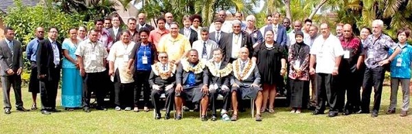
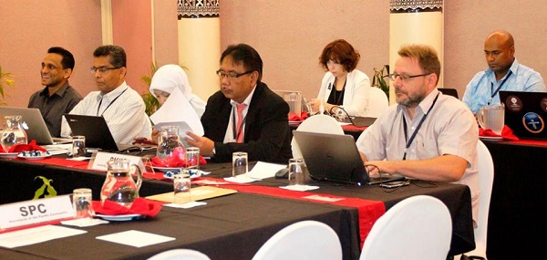
The first regional workshop of this project was held in Nadi, Fiji from 13th to 15th September 2016. There were representatives from nine Pacific Island countries namely Cook Island, Fiji, Kiribati, Micronesia, Papua New Guinea, Samoa, Solomon Islands, Tonga and Vanuatu. Other than that, experts from Asian Institute of Technology (AIT), Indonesian Agency for Meteorology Climatology and Geophysics (BMKG), United Nations Economic and Social Commission for Asia and the Pacific (ESCAP), Japan Aerospace Exploration Agency (JAXA), Korea Research Institute for Human Settlements (KRIHS), Geoscience Division Pacific Community (SPC) and Secretariat of the Pacific Regional Environment Program (SPREP) also attended the workshop.
Training on national geo-database and geo-portal for disaster risk reduction and sustainable development
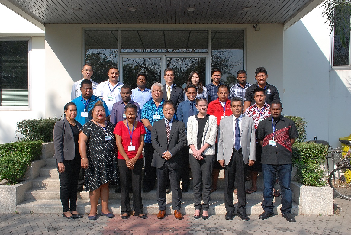
Geoinformatics Center (GIC) of the Asian Institute of Technology (AIT) in collaboration with United Nations Economic and Social Commission for Asia and the Pacific (ESCAP) organized a capacity building training program on national geo-database and geo-portal for disaster risk reduction and sustainable development. The program is held in GIC, AIT from 6 February to 3 March 2017. Twelve participants from eight Pacific Island countries participate this program. The participants hail from Cook Islands, Fiji, Kiribati, Micronesia, Samoa, Solomon Islands, Tonga, and Vanuatu.
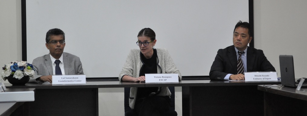
Ms. Tiziana Bonapace, Director, ICT and Disaster Risk Reduction Division, ESCAP, Mr. Hitoshi Kozaki, Head of International Organization Department and Deputy Permanent Representative to ESCAP, Embassy of Japan to Thailand, Dr. Lal Samarakoon, Director, GIC, inaugurated the program.
Related News: http://www.unescap.org/events/training-national-geo-database-and-geo-portal-disaster-risk-reduction-and-sustainable