
Area : Myanmar
Client : JAXA
Start Year : Apr 2015
End Year : Mar 2016
Partners : –
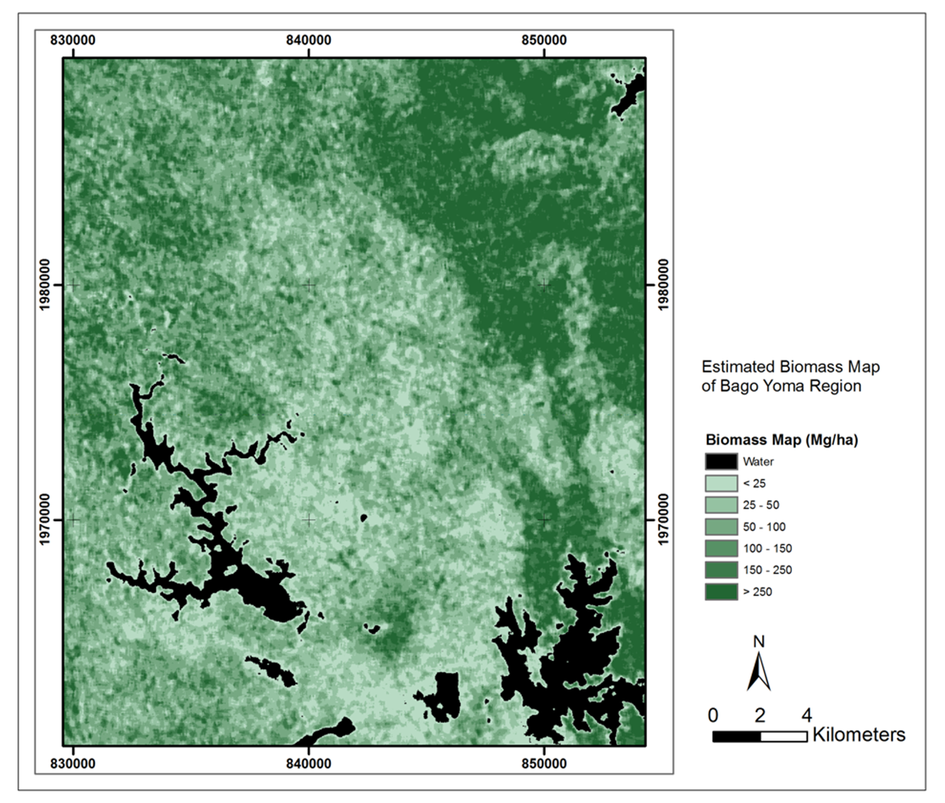


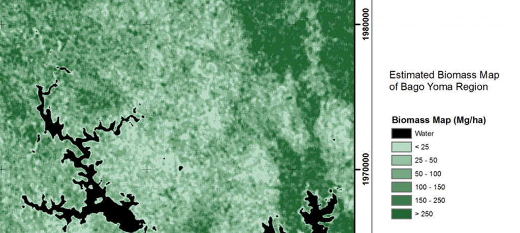
Biomass Estimation using SAR Data in Nancho Reserve Forest and Bago Yoma Region, Myanmar
The objectives of this project were: 1) To strengthen the capacity of technical officers in the utilization of space technology and GIS for forest biomass estimation in the selected study area, 2) To model the relationship between the backscatter of ALOS-2 data and ground biomass, and 3) To create a biomass estimation map of the selected study area in Myanmar.
Myanmar has one of the most extensive forest covers in mainland Southeast Asia – almost 47% of the total land area is forested, i.e., areas with a minimum canopy cover threshold of more than 10%. Myanmar’s forests have been facing much pressure from increased resource utilization associated with population growth, high demand from neighboring countries, and hydroelectric development. Myanmar’s forest areas were reduced from 49% in 2005 to 47% in 2010. Deforestation and forest degradation between 1989 and 2006 in the Bago Mountains area, Myanmar, revealed that the annual rate of forest degradation was much higher (2.5%) than that of deforestation (0.2%).
Accurate information related to the spatial distribution of forests, their extents, and other forest properties is critical for management purposes. Most research studies the relationship between remote sensing data and forest parameters in homogeneous and tropical rainforests. However, the relationship between remote sensing data and forest parameters in tropical dry forests, including tropical mixed deciduous forests (complex forest stand structure with abundant species), especially in Myanmar, is very limited. Due to this reason, research for developing an estimation model of stand parameters is an essential initial step in utilizing remotely sensed data for estimating forest structure and calculating biomass.
In this project, biomass estimation was achieved by modeling the relationship between field data and remote sensing data. When the relationship is statistically significant, a biomass map can be produced. Based on the result, only data from the Bago Yoma region gives a statistically significant result. This implies that a significant number of samples are needed to estimate the forest structure parameters with SAR.