

Area : Indonesia
Client : JAXA
Start Year : Apr 2015
End Year : Mar 2016
Partners : LAPAN, BNPB
Landslide Susceptibility Modelling and Mapping in Banjarnegara and Garut Districts, Indonesia
The objectives of this project were: 1) To prepare a landslide susceptibility map for Garut district using a logistic regression model, 2) To prepare a population exposure map for landslides in Garut district, and 3) To assess the applicability of using SAR images to identify landslides (a case study of the Banjarnegara landslide).
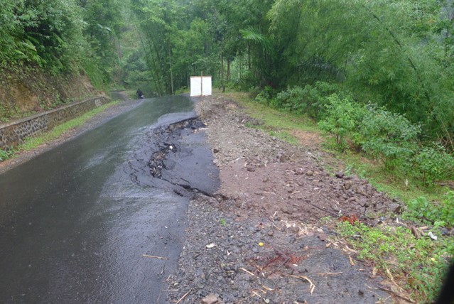
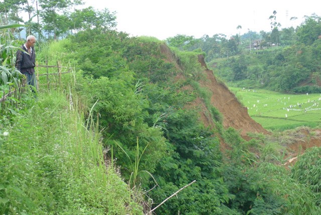
Garut District, located in West Java Province, is one of the highly vulnerable districts for landslides in Indonesia according to BNPB data. Furthermore, a large-scale landslide that happened in the Banjarnegara district on 13 December 2014, which killed 99 people and injured 24 people, was selected for a SAR data analysis case study.
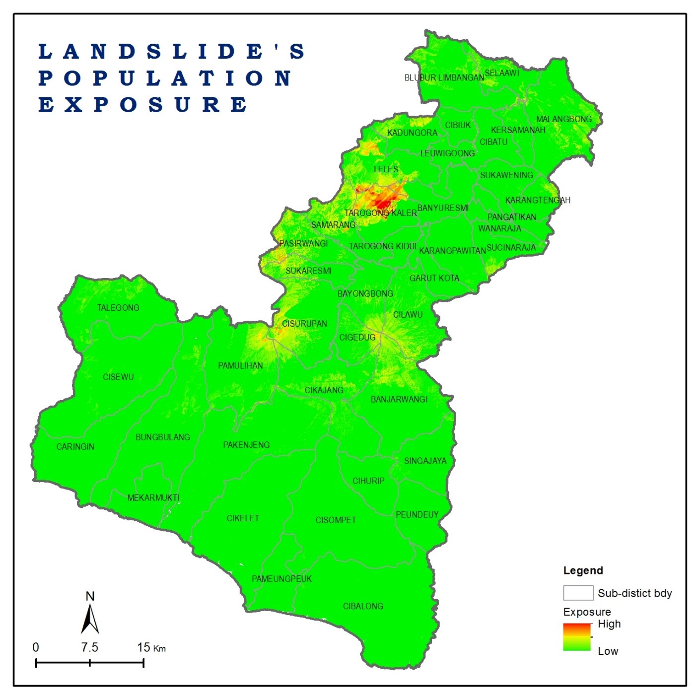
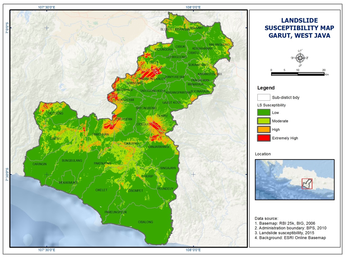
Several parameters were used for susceptibility mapping based on their contribution to the landslide probability. These parameters were slope, aspect, land use, roads, rivers, soil, lithology, faults, and annual rainfall. Data processing included pre-processing, weighted processing, and logistic regression processing. The ArcSDM toolbox in ArcGIS was used for data processing and analysis. The output of the logistic regression process was a raster map of landslide probability and a table of coefficients for each parameter; the higher the coefficient number, the higher the influence on a landslide occurrence. Distance from a fault was identified as a major contributing factor confirming the occurrence of seismically induced landslides in this study area. Based on the susceptibility map, a landslide exposure map was prepared using population data.
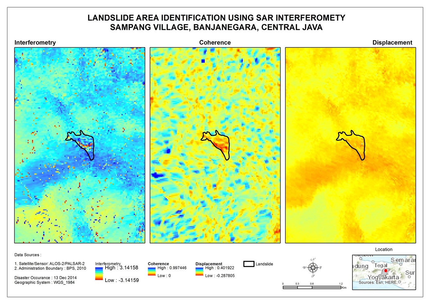
Backscatter changes between pre- and post-landslide were used to identify landslides using ALOS-2 data. When the landslides occurred, the surface was entirely of debris consisting of mud, logs, branches, parts of houses, etc. These characteristics make the surface rougher than before the landslide so that the value of the radar backscatter increases. Another method used was SAR interferometry, which produced Interferogram, coherence, and displacement maps.