
Area : Kailali and Chitwan, Nepal
Client : JAXA
Start Year : Apr 2012
End Year : Mar 2013
Partners : –

Development of a Forest Canopy and Biomass Measuring Technique using Remote Sensing
The objectives of this project were 1) To investigate the potential use of ALOS/PALSAR data for biomass estimation, 2) To investigate the potential use of object-based classification method for biomass estimation using a Very High Resolution (VHR) image, 3) To estimate the forest tree height from LiDAR data.
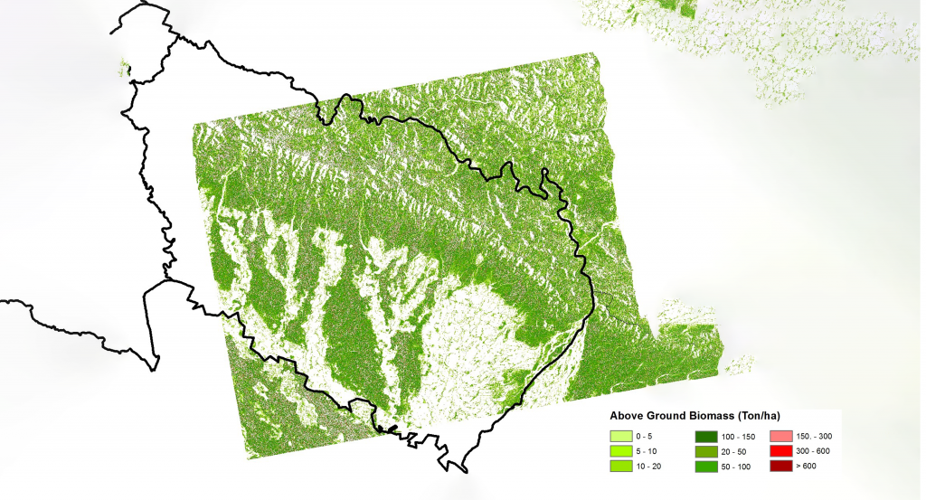
The dual-polarization of ALOS/PALSAR data was processed to derive backscatter coefficient values (in decibels) using a sequence of processing steps, including terrain correction, co-registration, radiometric calibration, and adaptive filtering. A non-linear regression approach was used to develop a biomass model using the correlation between the backscatter coefficients and the AGB values measured from the field. The model successfully produced a biomass map that shows the spatial distribution of forest biomass in a wide range of biomass values; however, the accuracy of the model was limited by the saturation level of around 100-150 t/ha; thus, the accuracy of biomass estimation above could not be ascertained.
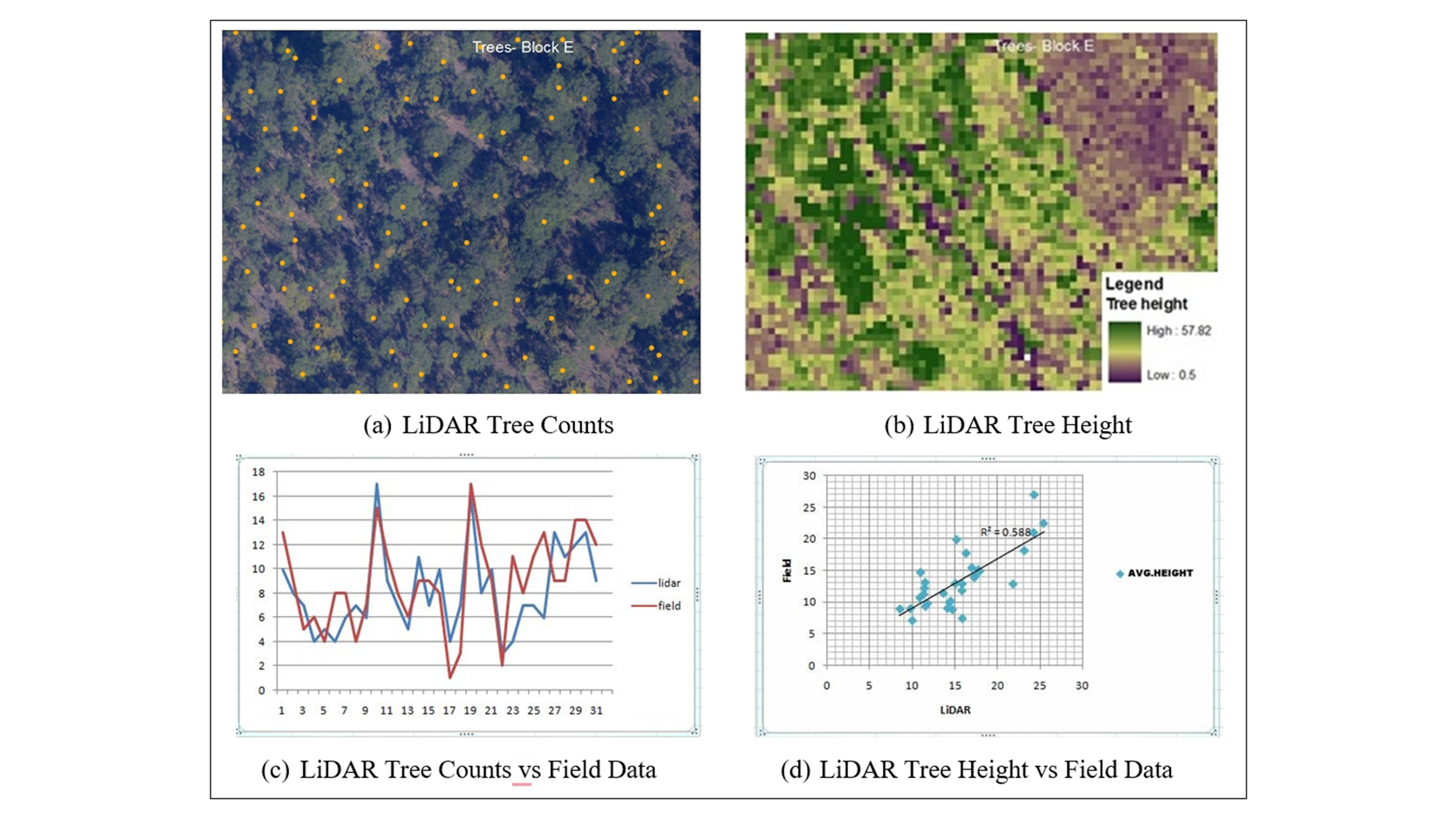
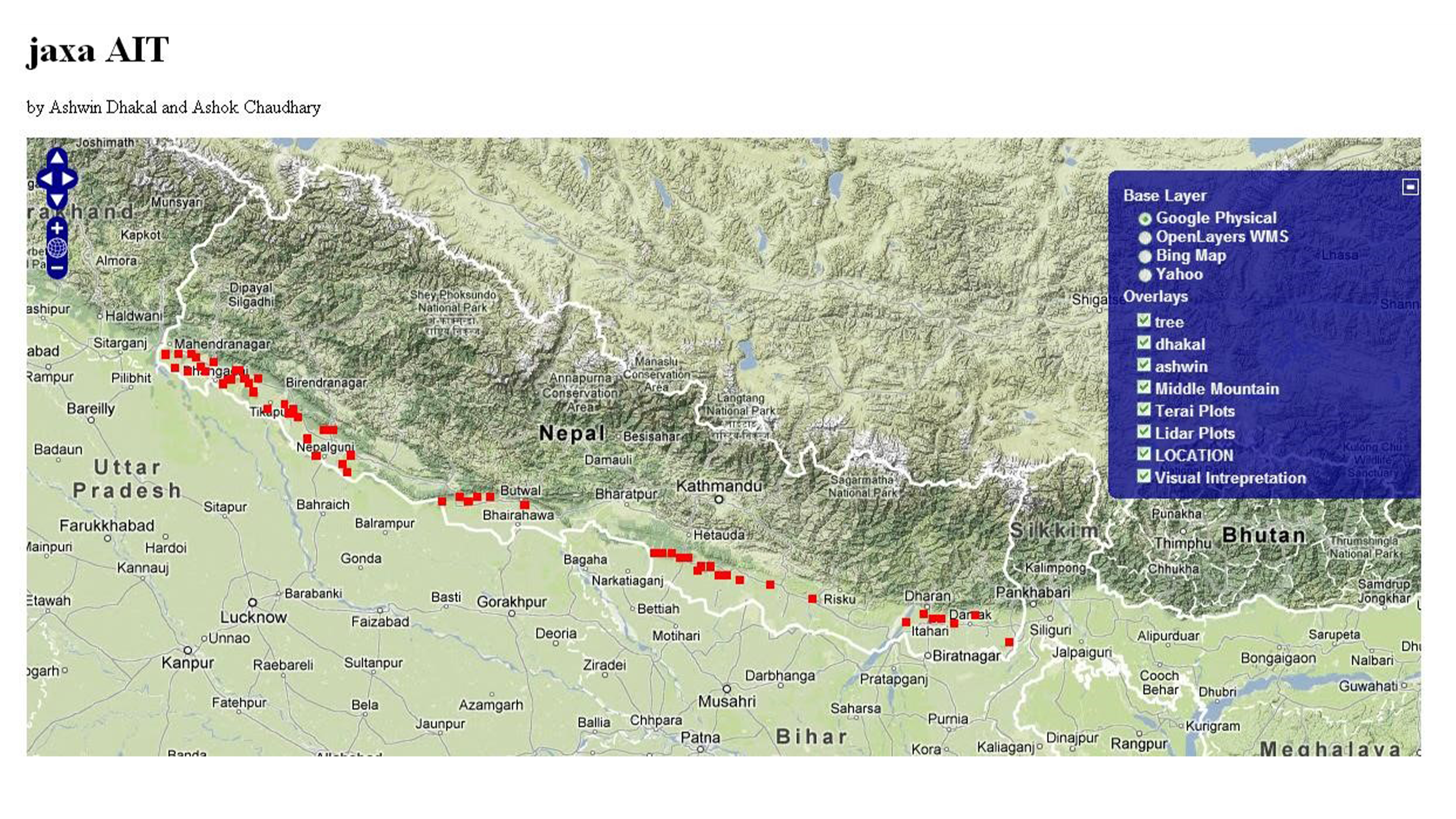
The potential of texture analysis for the improvement of forest biomass estimation beyond the saturation point of ALOS/PALSAR data was also investigated in the mountainous areas of the Chitwan area; however, it proved to be very challenging due to the complex terrain characteristics, forest types, and climatic conditions. The results showed negligible correlation with the field AGB in all cases. An object-based classification method was applied to a Very High Resolution (VHR) image for delineating an individual tree crown. The results were compared with the manual delineation, and then the carbon stock was calculated based on the Crown Projection Area (CPA). Meanwhile, the LiDAR data were also utilized to estimate the number of trees and the average height of several observation plots. The results showed a moderate height estimation accuracy (r2 = 0.6) compared with the field data. Finally, a web-mapping platform is being established to disseminate the project’s output to other stakeholders.