
Area : Philippines
Client : JAXA
Start Year : Sept 2013
End Year : Mar 2014
Partners : –


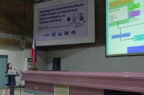
Flood Hazard and Exposure Mapping: A Case Study in Olongapo City, Zambales
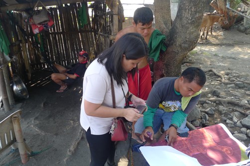
Olongapo city is classified as a highly urbanized city, located in the southern entry point of Zambales province in the Philippines. It has a total land area of 103 km2. The drainage system of the city consists of roadside ditches and open canals that drain through natural channels and rivers. The river beds are heavily silted due to sand deposits in the mountain slopes. The population density of this city is 89 persons per hectare. Due to its geographical location and hilly terrains, the city is usually affected by flash floods. A database of elements-at-risk such as building footprints, critical infrastructure and population were digitized and overlaid with flood hazard maps to obtain exposure maps. The building footprints were created using the OSM. Critical infrastructure such as school, hospital, public buildings, roads, bridges and other information were obtained from the field survey. The population data used in this project were extracted from Asia Pop data.
Flood hazard maps provided by PAGASA was derived using the geo-morphological analysis utilizing the topographical maps and aerial photographs. The flood hazard map available for Olongapo city was divided into three categories as low, moderate and high. Fifteen out of seventeen barangays were identified as highly susceptible to flood covering 30% of total land area of Olongapo city. A total of 7,437 buildings out of 26,012 of the total buildings were classified as highly susceptible to flooding.
At the emergency response phase during a disaster, the Sentinel Asia will be activated to provide satellite data before and during the flood and it will be processed to prepare the flood maps. The flood map will then be combined with the elements-at-risk database to provide value-added products for disaster response.