
Area : Central Java
Client : JAXA
Start Year : Apr 2012
End Year : Mar 2013
Partners : –


Study of Flood Inundation due to Sea Level Rise in Pekalongan in Central Java
The objectives of this project were:
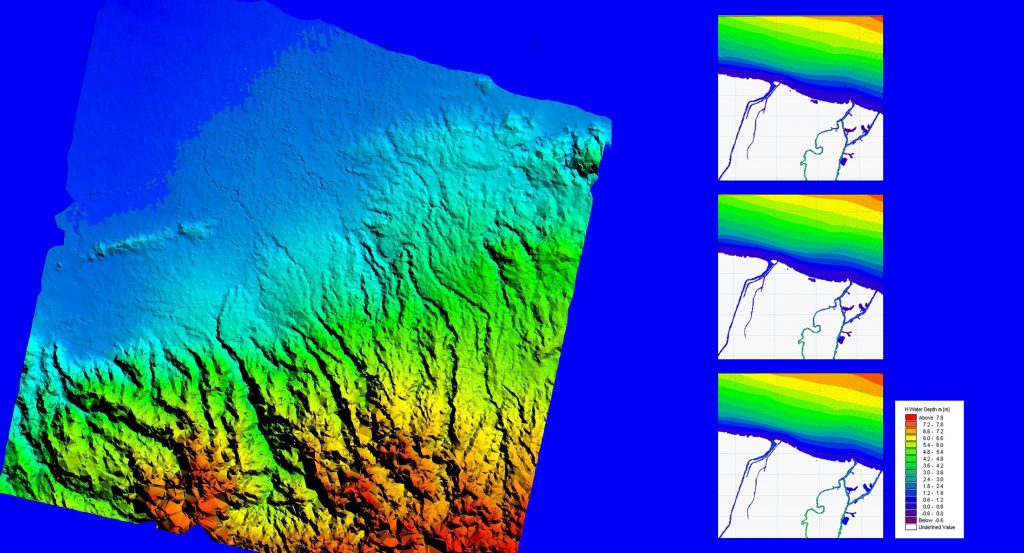
- To derive flood inundation maps using MIKE-11 flood models
- To derive land subsidence maps using SAR interferometry technique.
Tidal floods or ‘rob’ in the coastal city of Pekalongan, Central Java, will likely intensify in the future. This study will provide some indications to the city planners for taking mitigation measures. The MIKE-11 models were used to simulate and predict the flood inundation area. Given the complexity of the problem and the non-availability of some of the data necessary for the simulations, the study was restricted to a limited area where most of the population and infrastructures exist. ALOS/PRISM images with different combinations of stereoscopic images such as Nadir-Forward, Backward-Nadir, Backward-Forward, and Backward-Nadir-Forward (triplet) were used to generate a Digital Elevation Model (DEM). The tidal flood simulations were carried out for three scenarios of sea level rise: 1) current situation, 2) next 50 years, assuming no sea level rise, and 3) next 50 years, assuming 50 cm of sea level rise. The expected ranges of water level rise in Pekalongan city for each scenario are 0.23-1.27 m, 0.36-1.38 m, and 0.65-1.53 m, respectively. Meanwhile, the possibility of land subsidence in Pekalongan city was investigated using a series of ground displacement maps derived from the ALOS/PALSAR data using the Interferometric Synthetic Aperture Radar (InSAR) technique. The results showed that the average value of land subsidence rate in Pekalongan city is 3 cm/year, and the subsidence mainly occurred in the western part of the city.