
Area : Vietnam
Client : JAXA
Start Year : Sept 2014
End Year : Mar 2015
Partners : STI, DMC


Application of Remote Sensing and GIS for Flood Mapping and Emergency Responses in selected river basin in Vietnam
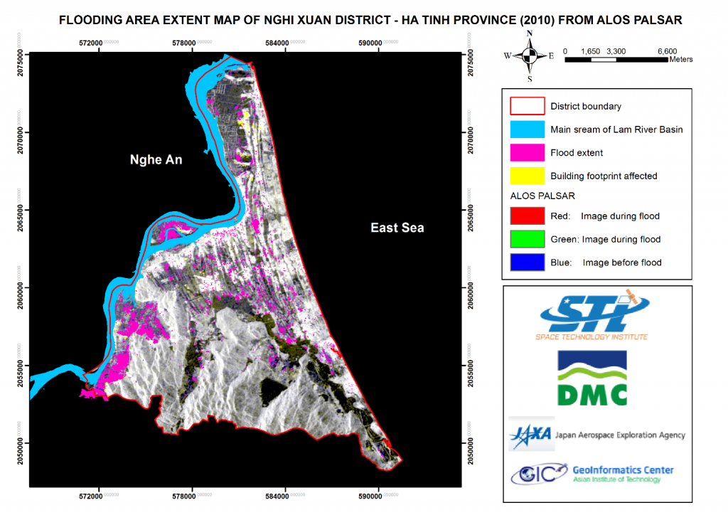
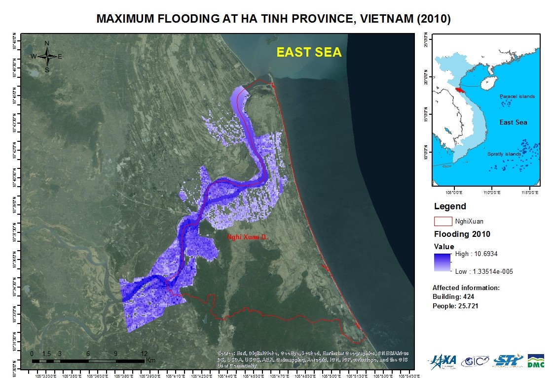
Vietnam has more than 3000 km of coastal line which receives many tropical storms from East Sea every year and flood are accepted as a given fact. In recent years, with climate change scenarios, there is an increase in frequency and magnitude of the extreme events including floods. In the year 2010, there was the biggest flood event in the history causing significant damages, particularly in Ha Tinh Provide, many people lost their lives and there was huge property damges costing thousand of billions. Thus, with the effectiveness of modern day geospatial technologies such as remote sensing, GIS and hydrological modeling in hazard and risk management, it is aimed to delineate the flood extent and map the element at risk towards increased awareness, preparedness and sustainable development. For this study two study area were selected a) Lam River Basin in Ha Tinh province and b) Than Hoa province
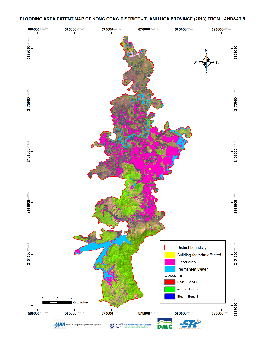
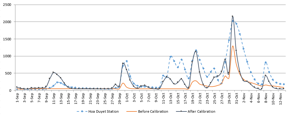
For this study, IFAS model was setup using 3 km DEM, global land use and soil map. The model was calibrated and validated using the observed rainfall data. The model is calibrated using 3 tank layer configuration during the flood event. The model is calibrated with the satisfactory model performance of NSE greater than 0.6 and coefficient of determination (R2¬¬¬) greater than 0.7. After the calibration and validation of the IFAS model, it was simulated for various flooding event. The biggest flooding event was during January 2014. This study was extended with the development of 1D flood model using HEC RAS for the downstream part of the watershed where the flooding occurs very frequently. After developing the HEC RAS model for the study area, flood map was prepared.
Similarly, ALOS/PALSAR data was processed to generate the flood map. These flood maps generated from the model and ALOS/PALSAR were overlaid with the building footprints. For the population affected by floods, maps were again overlaid with the population density maps obtained from the Asia pop to get a quick estimation of the number of people affected by the floods. The Mini-Project result would be useful to prepare the value added products at the time of flooding and provide the quick response during any flooding event. DMC together with the other relevant departments of the country are willing to utilize the results by building a Geo-Portal so that such information can be updated, shared and at the same time provided to a larger audience in a much lesser time for effective decision-making.