
Area : Cambodia
Client : JAXA
Start Year : Sept 2014
End Year : Mar 2015
Partners : DPS, MAFF


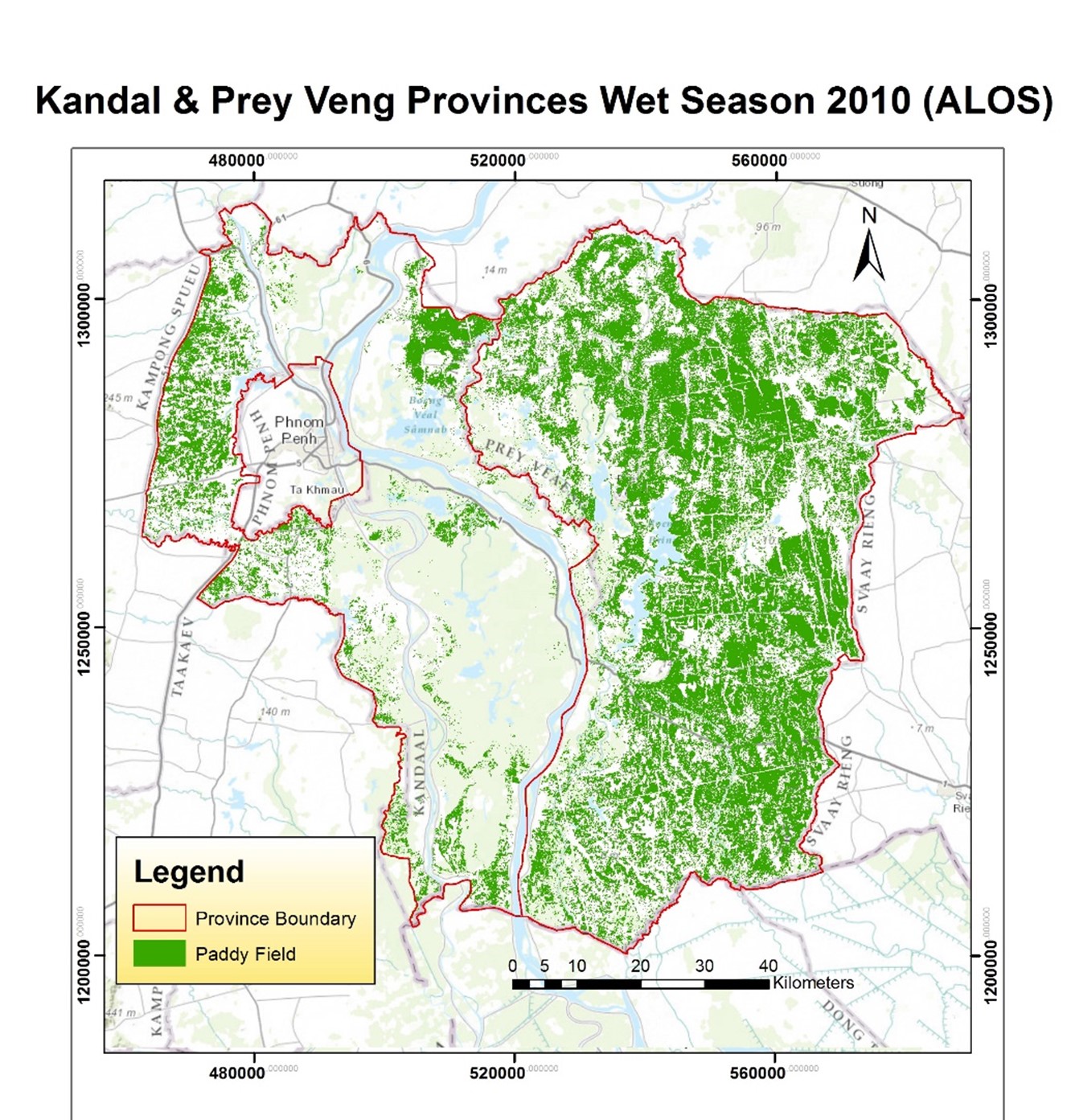
Paddy Area Mapping using ALOS/PALSAR and MODIS NDVI Data in Kandal and Prey Veng Provinces in Cambodia
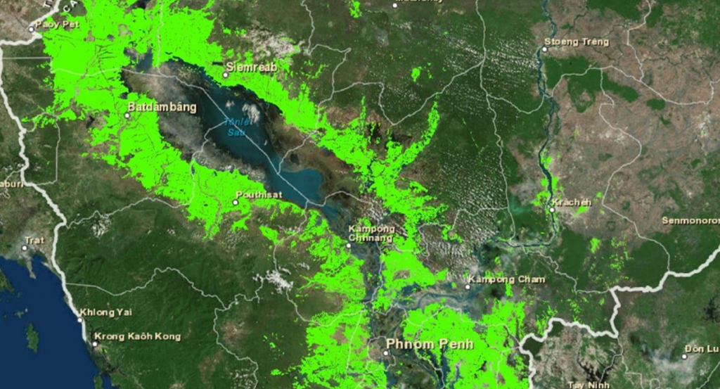
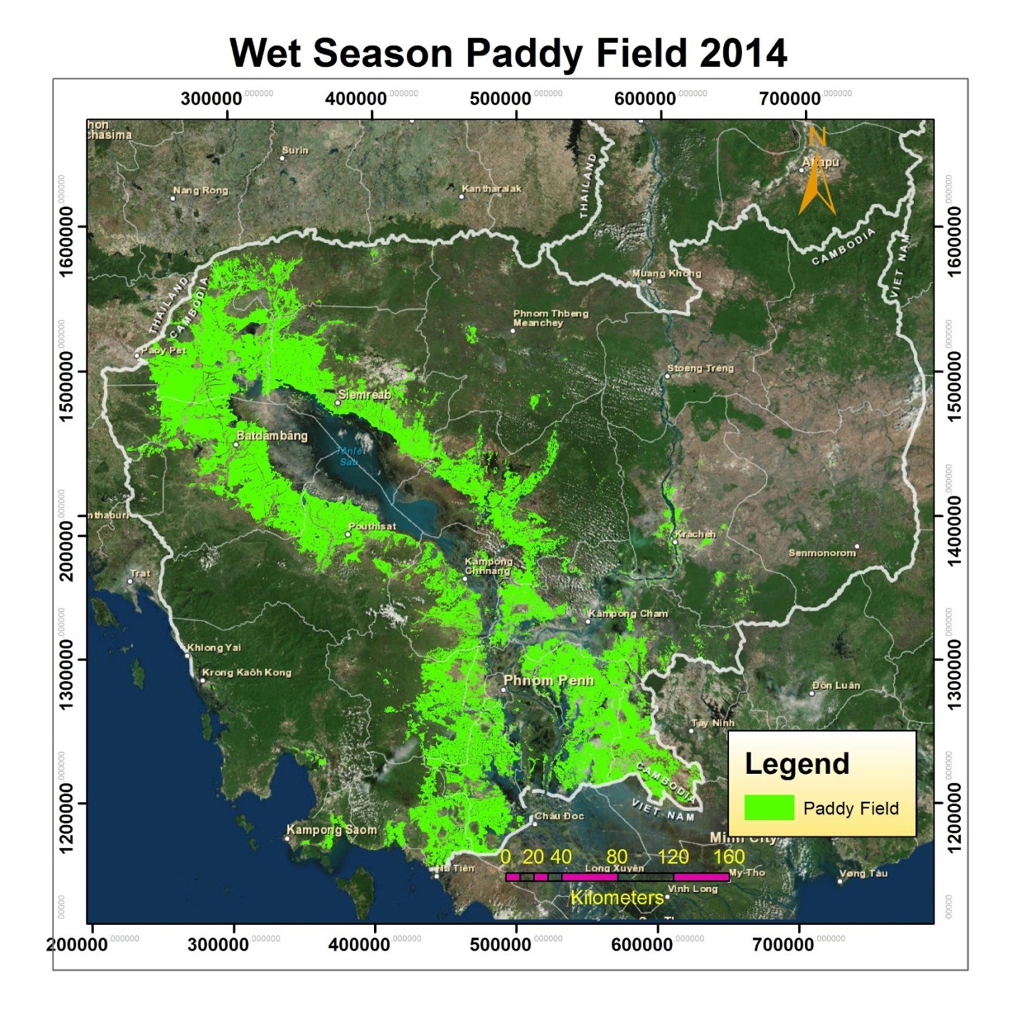
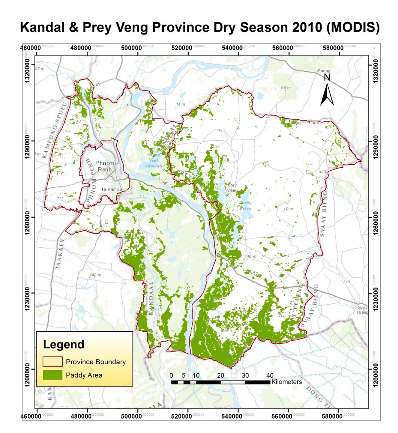
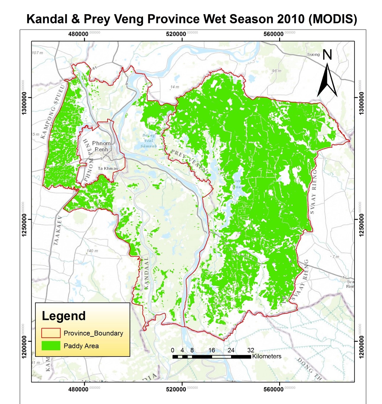
Rice is the major crop in the Mekong region, including Cambodia. Over 3 million hectares of rice is cultivated in a year with two seasons, the wet season (May to October) and dry season (November to April in the following year). The study area covers two of the major rice-cultivating provinces, which are Prey Veng and Kandal Provinces.
Optical data (MODIS NDVI) and microwave data (ALOS/PALSAR) were used for this analysis. The distinct pattern in the NDVI value of the optical data and the backscatter values of the microwave data that emerged in the paddy fields area was used to map the paddy fields area in the study area. Results from optical data analysis and microwave data analysis were compared with respect to the field statistics data that were collected from the Department of Planning and Statistics (DPS). The main objective of this comparison was to test the main limitations of MODIS optical data (invisibility due to cloud, coarser spatial resolution) against microwave data. The effect of using microwave data for crop monitoring was prominent in the resulting comparison.
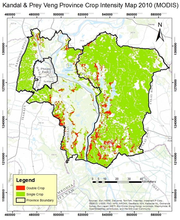
Other than that, a crop intensity map containing the distribution of single and double crop areas was also produced in the study area. Finally, the distribution of the paddy fields area in the wet season, which is the major season for rice cultivation, was mapped for the whole of Cambodia with a 250m resolution using MODIS NDVI data.