Geoinformatics Center has been appointed as one of the project managers for the International Disaster Charter Activation. The registered activation no. 809 compiled the information of the landslide mapping in Natuna Regency, Riau Islands, Indonesia.
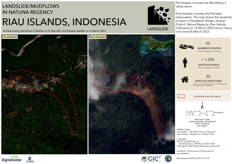
From the latest occurrence of landslides which triggered by six days torrential rains in Natuna Regency, it caused 15 people days and remaining missing of 2 people. The landslides occurred on Monday on the island of Serasan, which is home to about 8,000 people. More than 1,200 people have been displaced and taken to evacuation centers. Thus, the disaster got the respond by ADRC (Asian Disaster Reduction Center), on behalf of the National Research and Innovation Agency, Indonesia (BRIN), escalated this activation to the International Disaster Charter (IDC) to aid the overall map of the landslides monitoring.
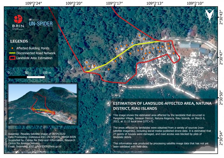
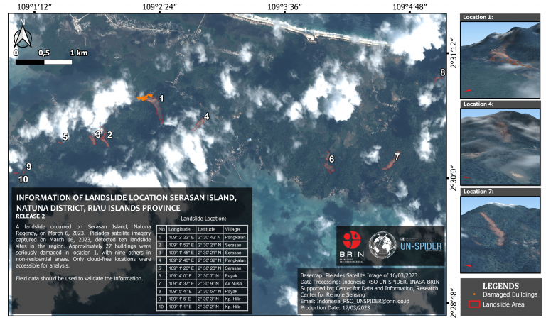
Angsana Chaksan, a Senior Research Associate from GIC; pointed as the project manager for this call. Along with National Research and Innovation Agency, Indonesia (BRIN); the immediate response for mapping has been elaborated. The team produced value-added products using Optical satellite images provided through the International Disaster Charter system. All the map products generated during the activation were shared with the end-user/requester (BRIN) to manage the disaster response activities. Approximately 30±2 sq km of the village area in Serasan Island affected by the landslides, which also shown in the map including the affected houses.
Activation site: https://disasterscharter.org/web/guest/activations/-/article/landslide-in-indonesia-activation-809-
Map produced by GIC: https://disasterscharter.org/image/journal/article.jpg?img_id=19672894&t=1679301586951