GNSS, or Global Navigation Satellite System, is a technology and methodology procedure to define the position, depending on the reference. GNSS particularly referred to the location identification in quantitative form from the earth surface based on the datum or system reference, GNSS is applied for the positioning, navigating and timing service. GNSS is closely related to the satellite positioning from GPS – Global Positioning Systems, which developed from NOAA, USA.
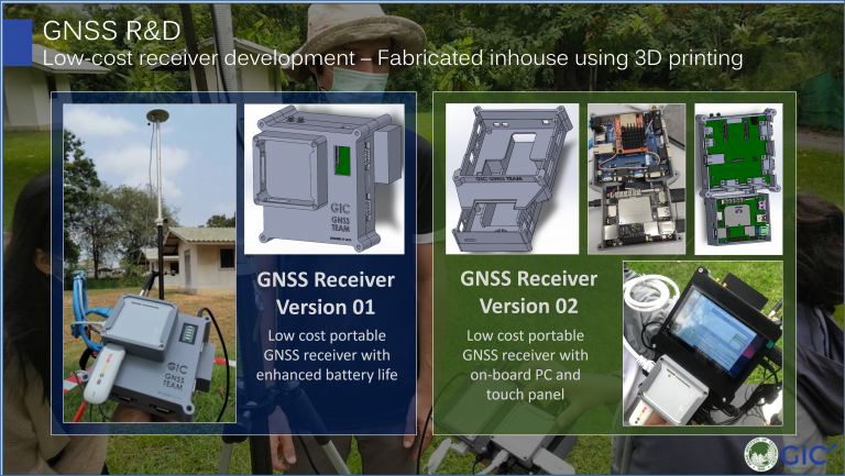
In GIC, the development of positioning device reaching out to enable the location information in accurate and precise manner. GNSS (Global Navigation Satellite System) is the positioning method for mapping. Our specialization is developing low-cost receiver development which using the fabricated inhouse 3D printing.
GIC explores the navigating systems for the positioning purposes. Our focus on positioning systems is to enable the technology of the receivers for the GNSS as the affordable yet cost effective device. As we provide the precision mapping in the field, we focus on enabling the friendly user tools of GPS which can be used in any conditions. Our work has been implemented in the local’s project on development for the positioning in high way project in Berunda (2017).