The age of big data is here, where vast amounts of information are incorporated into various systems. The Geoinformatics Center is taking steps to improve the management of this data and develop more effective information systems.
As a leading institution in the field of geoinformatics, GIC has developed expertise in various areas related to big data. It has developed techniques for processing and analysing spatial data, such as satellite imagery, geographic information systems (GIS), and remote sensing data. These techniques enable researchers to extract valuable insights from vast amounts of geospatial data, leading to new discoveries and improved decision-making.
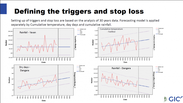
GIC has also been exploring the use of machine learning and artificial intelligence (AI) in analysing big data. By leveraging advanced algorithms and computational techniques, GIC researchers are developing new ways to extract insights and patterns from large and complex datasets. These techniques have potential applications in a range of fields, including environmental science, public health, urban planning, and disaster management.