
Area : Indonesia
Client : ADB
Start Year : Oct 2020
End Year : Mar 2023
Partners : RESTEC


TA-9554 REG: Southeast Asia Urban Services Facility Indonesia: Support for Emergency Assistance on Rehabilitation and Reconstruction in Central Sulawesi. Output 2: Monitoring and Evaluation of Reconstruction Efforts Enhanced
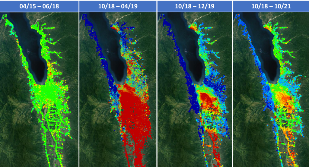
A magnitude of 7.5 earthquakes struck the Central Sulawesi Province of Indonesia on 28 September 2018, triggering a tsunami of 3-meter-height, widespread landslides, and staggering liquefaction, resulted in the loss of human lives, destruction of property, and severe damage to the public infrastructure. The worst affected area was Palu city and surrounding area, including Donggala and Sigi districts. To support the Government of Indonesia’s post-disaster reconstruction program, the Asian Development Bank (ADB) secured the Emergency Assistance on Rehabilitation and Reconstruction (EARR) project in Central Sulawesi with a grant from the Japan Fund for Poverty Reduction (JFPR). Under this project, AIT and RESTEC of Japan conducting damage assessment and reconstruction monitoring using satellite data.
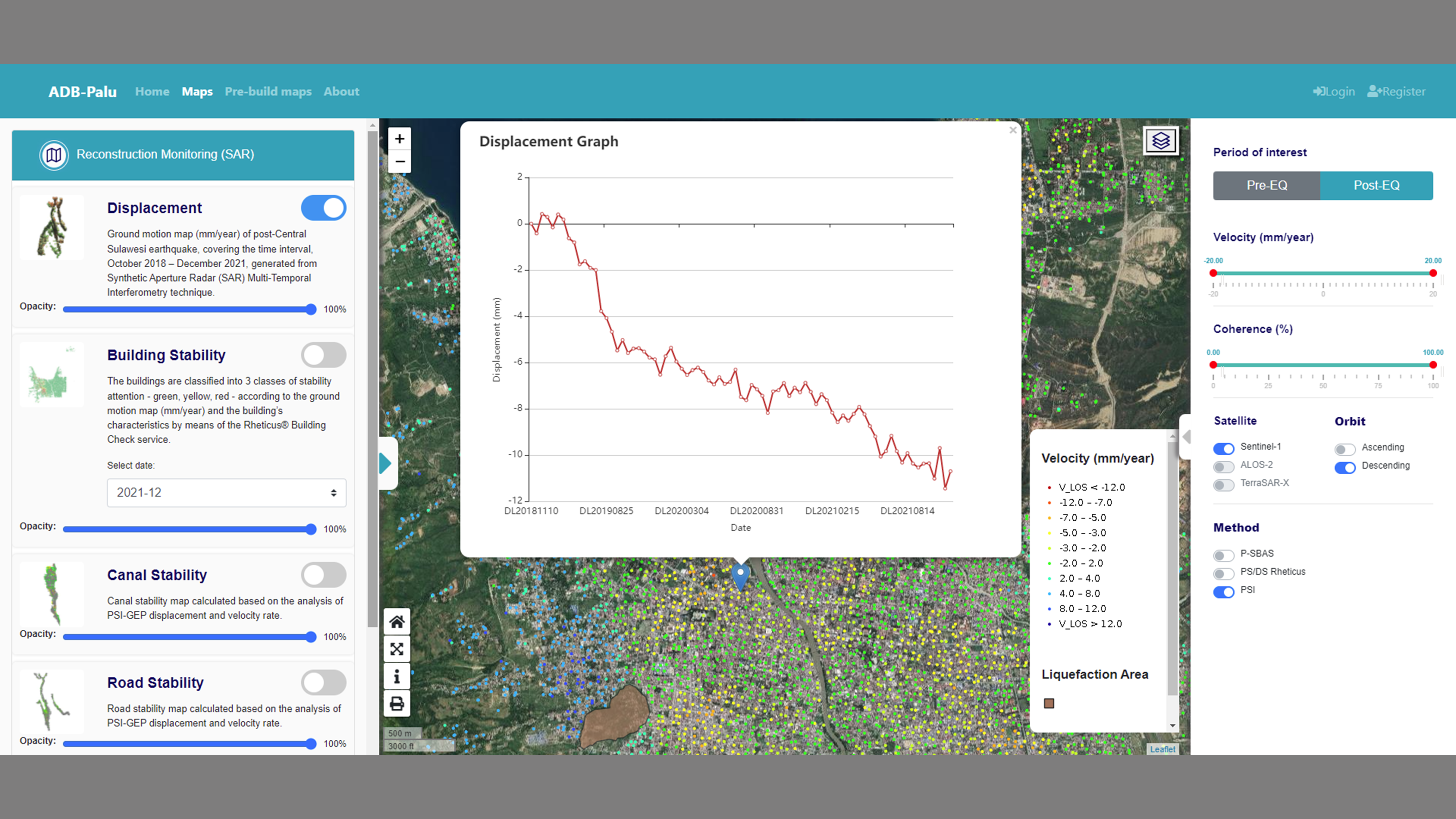
The project aims to provide information on critical infrastructure reconstruction, building, ground movements, and other information needed to support the post-earthquake reconstruction activities after the 2018 Central Sulawesi earthquake. We utilized both optical and radar satellite remote sensing data, employing visual image interpretation as well as advanced data processing techniques. We processed Sentinel-1 Synthetic Aperture Radar (SAR) images using Multi-temporal Interferometric SAR (MTI) techniques such as Small Baseline Subset (SBAS) and Persistent Scatterer Interferometry (PSI), in which a large number of SAR images from multiple acquisitions are taken overtimes to estimate the ground motion through the time-series displacement provided for each measured target. Very high-resolution optical data was also used for providing the post-earthquake status of buildings and other physical assets. Furthermore, Project Geoportal is developed as a user-friendly and interactive online platform to support the reconstruction monitoring activities and visualize satellite-based products.