Drone and 3D Technology
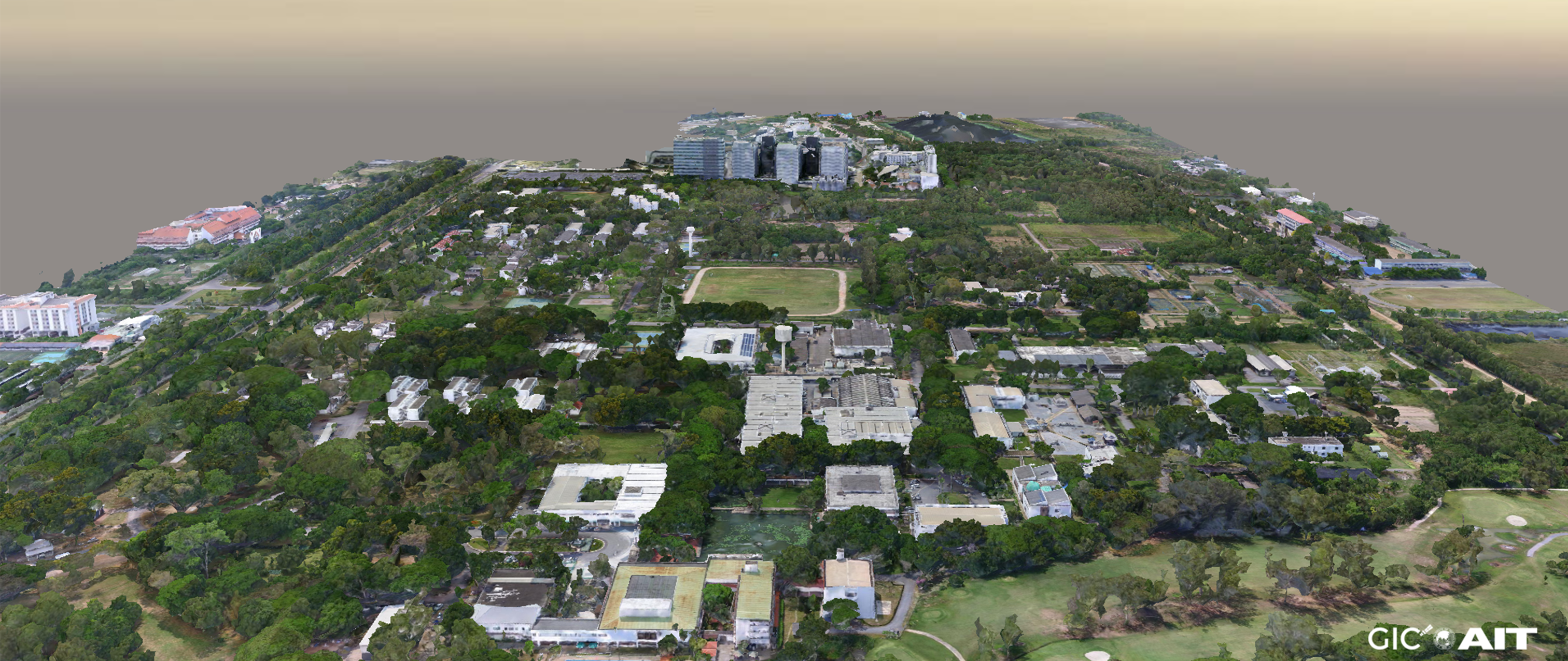
GIC developed a 3D model of Asian Institute of Technology (AIT) campus using Aerial Mapping

Asian Institute of Technology
GIC developed a 3D model of Asian Institute of Technology (AIT) campus using Aerial Mapping
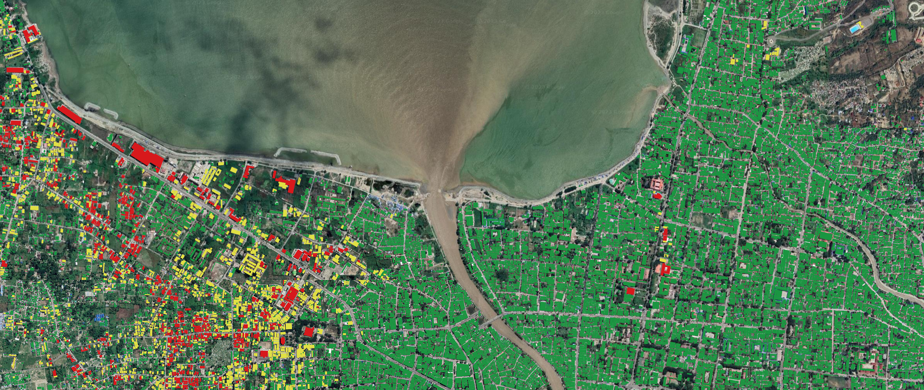
Utilizing optical and radar satellite remote sensing data, after the 2018 Earthquake and Tsunami in Central Sulawesi, Indonesia.
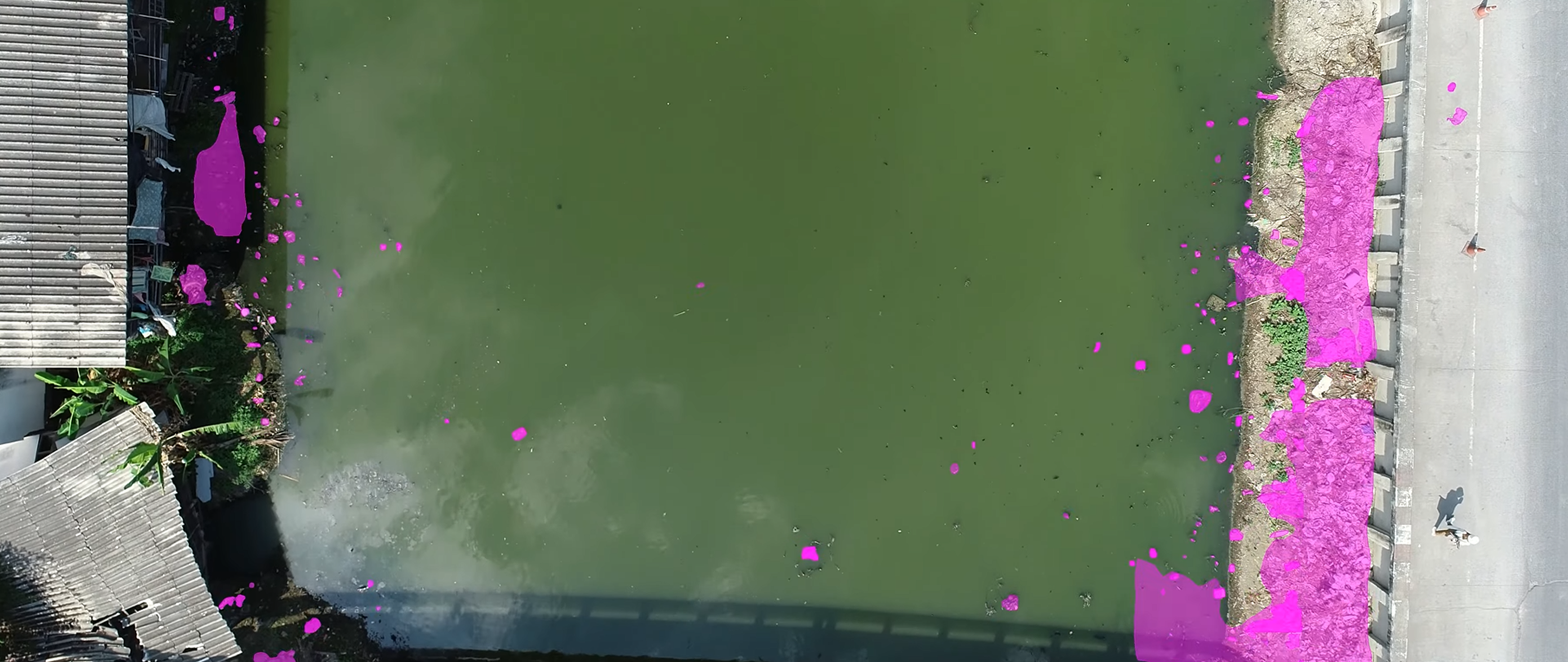
Enabling the AI and Machine Learning improve the automation in detecting plastic in the city.
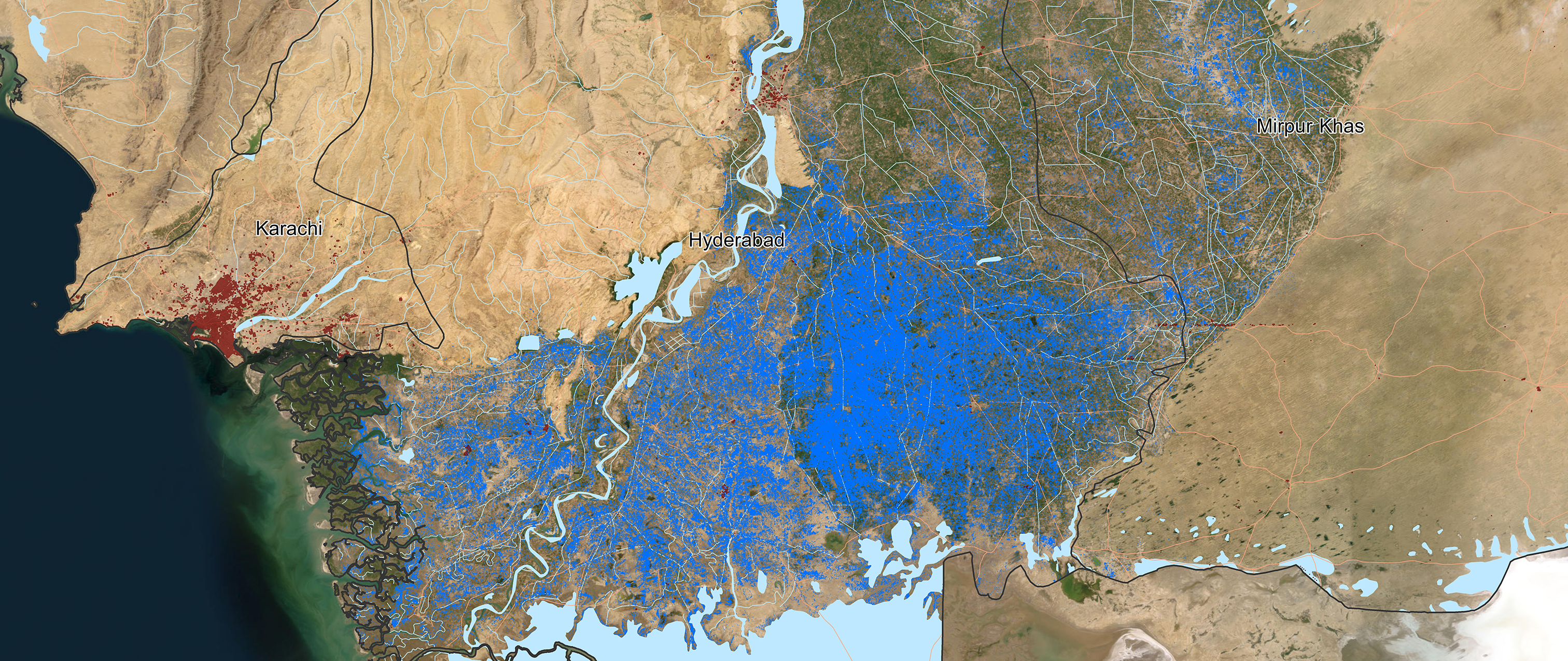
Detecting the flood extent at one of the catastrophe floods using the Satellite Mapping.
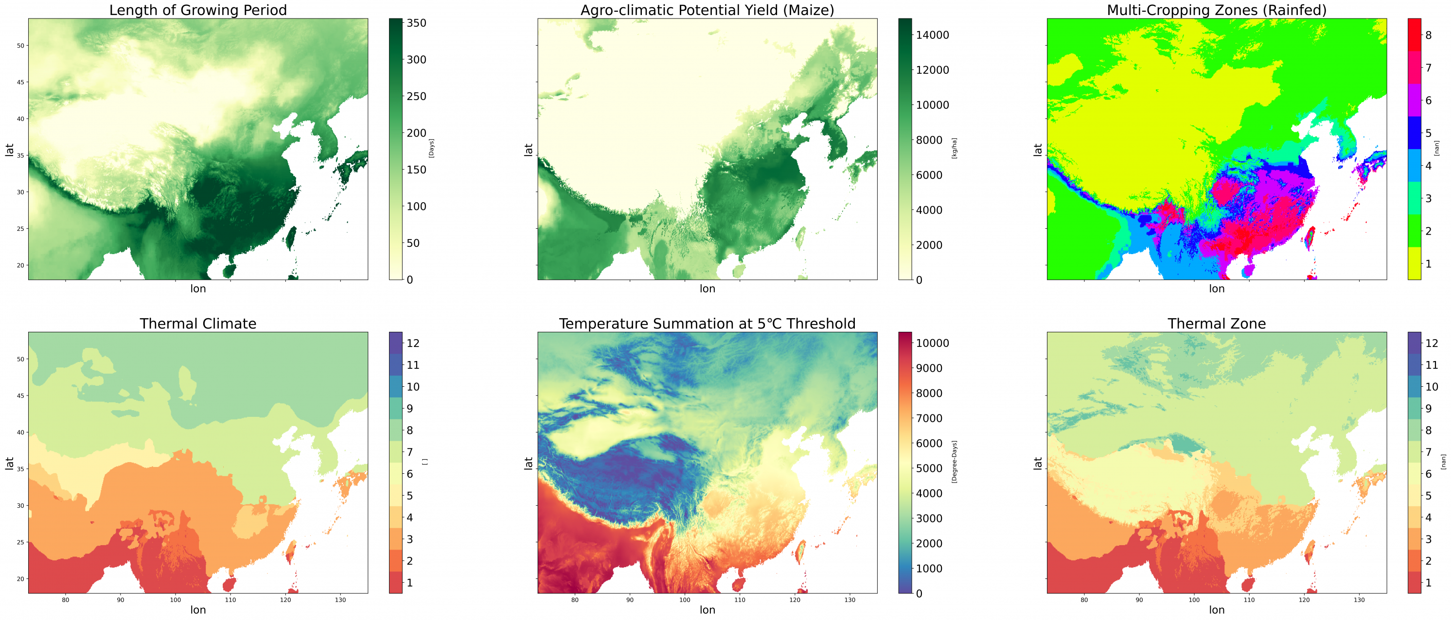
Tool development for assessing the crop suitability in certain areas, developed with open source technology.