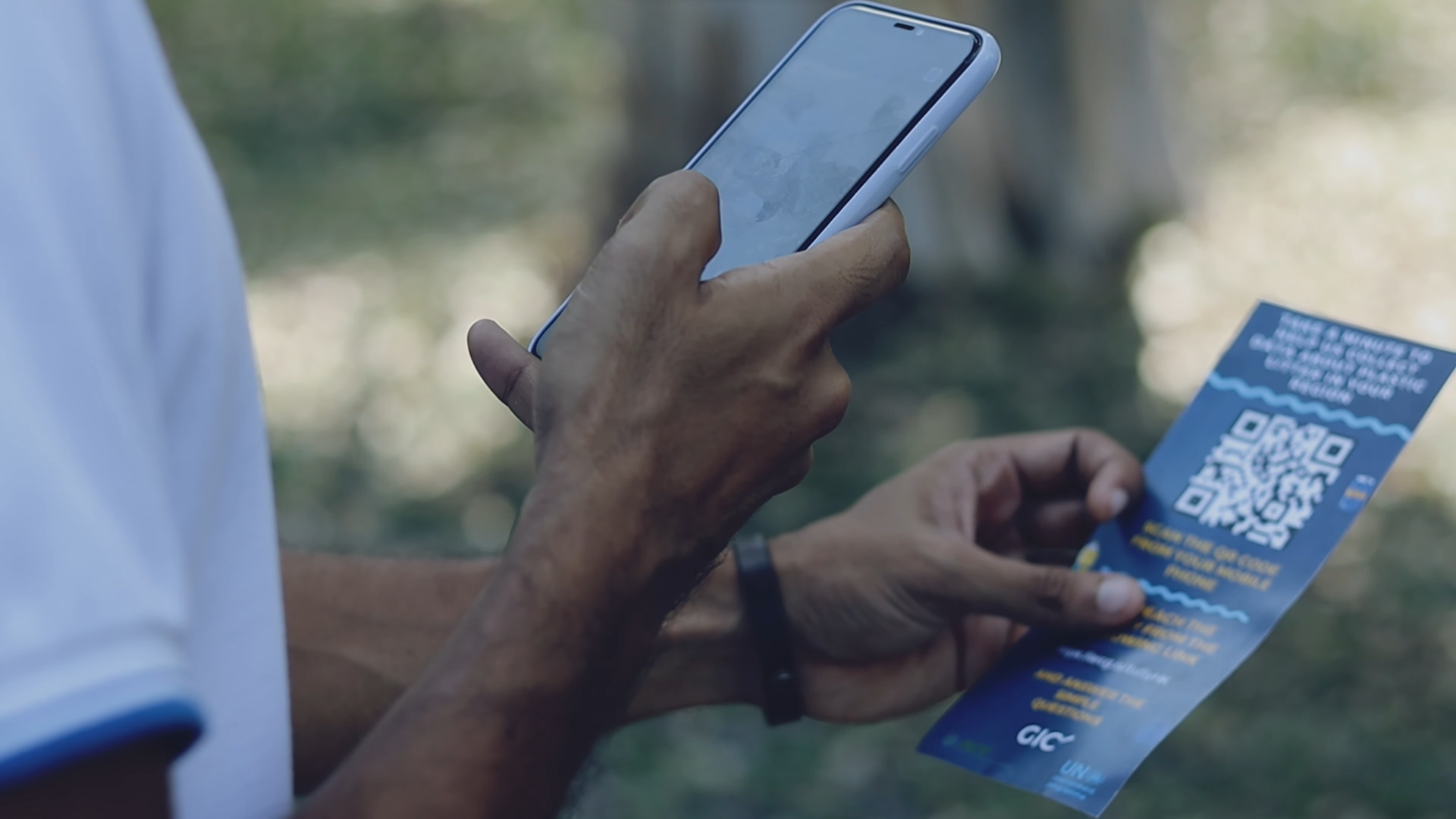
Mobile phones with GPS capabilities have opened the door to new possibilities for data collection, mapping, and analysis. These devices offer a cost-effective and user-friendly solution for capturing and sharing location-based information, enabling a wide range of applications in various fields, including but not limited to disaster management, urban planning, and waste management.
Geoinformatics Center, leverages the ubiquitous nature of mobile devices, and has engaged communities and stakeholders in various projects, allowing for more inclusive and participatory decision-making processes. Our experience with the Mobile GIS solution has proven to be efficient and accurate for field operation, rapid data collection and seamless integration, and collecting digital data on ground, eliminating the need for paper-based workflows. Such benefits help us and the stakeholders for timely and informed decision making.
The Geoinformatics Center has experience of the potential of mobile applications in promoting spatial literacy and empowering communities to participate in decision-making processes. The ground-based data collection and participatory approach supports the stakeholders to formulate evidence-based policies and programs.
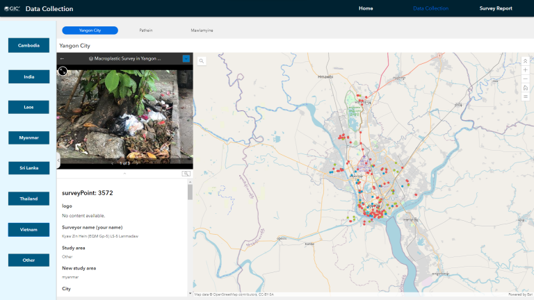
The mobile application developed supports our work on collecting ground truth data and collecting waste management information for projects like plastic litter monitoring, agricultural and disaster surveys.
Mobile Application in Disaster Response
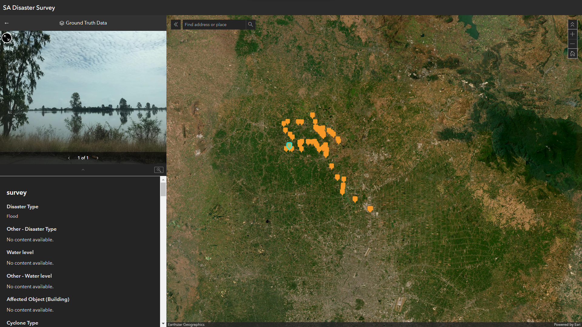
Validation and feedback of Value-added products (VAPs) are the most important but challenging tasks and have little attention during a disaster. In terms of validation of the VAPs, the ground truth data should be available within the disaster period. Then the results can be validated and improved simultaneously, and good results can be provided to the users.
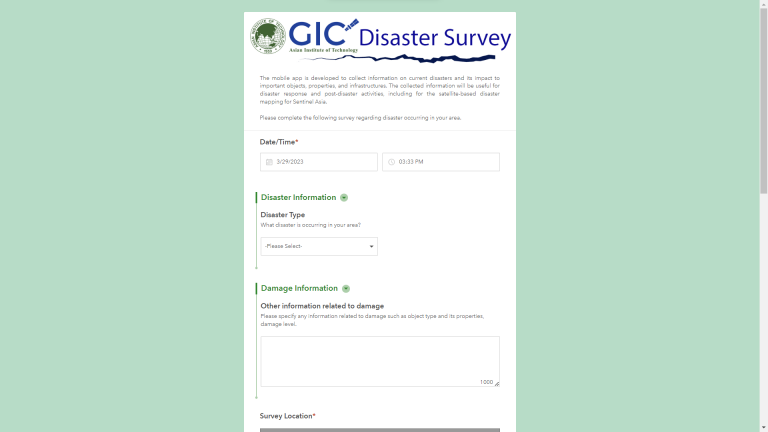
To improve the involvement of the ground truth data for validation purposes, we have developed a mobile application (GIC Disaster Survey – Link: https://arcg.is/1HWGWX0) which is crowd-sourcing data collection survey, and it can be used effectively for validation of the produced results.