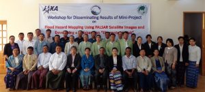
Flood Hazard and Exposure Mapping along Brahmaputra River
Area : BangladeshClient : JAXAStart Year : Sept 2013End Year : Mar 2014Partners : – Flood Hazard and Exposure Mapping: A Case Study in Olongapo City, Zambales Read More

Area : BangladeshClient : JAXAStart Year : Sept 2013End Year : Mar 2014Partners : – Flood Hazard and Exposure Mapping: A Case Study in Olongapo City, Zambales Read More

Area : PhilippinesClient : JAXAStart Year : Sept 2013End Year : Mar 2014Partners : – Flood Hazard and Exposure Mapping: A Case Study in Olongapo City, Zambales Read More

In recent years, satellite imagery, drone imagery and CCTV cameras have become increasingly ubiquitous and accessible, providing valuable data for a wide range of applications, from monitoring natural disasters to agriculture monitoring, environmental monitoring, etc. However, analysing this data Read More