Skip to content
  • Home
  • About Us
    • About GIC
    • GIC Board
    • Our Team
    • Contact Us
    • News
      • Recent news
      • newsletter
    • Blog
  • Services
    • Remote Sensing and GIS
    • Disaster Management
    • Environment
  • Training
    • Training Programs
    • Training Facilities
    • Internships
  • Projects
  • Research & Products
    • Disaster Response Portal
    • Regional Spatial Data
    • Satellite-based drought monitoring and Early Warning
    • GNSS
    • Asian Journal of Geoinfomatics
    • Publications
    • Our Blog Articles
  • (+66) 02 524 5580
  • geoinfo@ait.ac.th
  • Pathum Thani, Thailand
Geoinformatics Center

Geoinformatics Center

Asian Institute of Technology

  • Home
  • About Us
    • About GIC
    • GIC Board
    • Our Team
    • Contact Us
    • News
      • Recent news
      • newsletter
    • Blog
  • Services
    • Remote Sensing and GIS
    • Disaster Management
    • Environment
  • Training
    • Training Programs
    • Training Facilities
    • Internships
  • Projects
  • Research & Products
    • Disaster Response Portal
    • Regional Spatial Data
    • Satellite-based drought monitoring and Early Warning
    • GNSS
    • Asian Journal of Geoinfomatics
    • Publications
    • Our Blog Articles

Category: Projects

  • Home
  • Projects
  • Page 22

Application of Multi-temporal Satellite Data for Land-Use/Land-Cover Change and Flood Mapping in the Coastal Zone of Vietnam

Application of Multi-temporal Satellite Data for Land-Use/Land-Cover Change and Flood Mapping in the Coastal Zone of Vietnam Year: 2005-2006Country: VietnamLocation within country: Mekong delta Descriptions The objectives of this project were: 1) To develop a methodology for landcover/landuse mapping Read More

Application of Remote Sensing and GIS for Flood Monitoring and Mitigation Measures in Munshiganj District

Application of Remote Sensing and GIS for Flood Monitoring and Mitigation Measures in Munshiganj District Year: 2004-2005Country: BangladeshLocation within country: Munshiganj district Descriptions The objectives of the project were: 1) To develop a methodology for detecting area affected by Read More

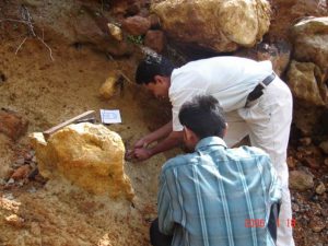
Application of Conventional and Spatial Data in Detection of Underground Karsticic Formations to Store Excess Extreme Floodwater Flows in the Red River Delta in Vietnam

Application of Conventional and Spatial Data in Detection of Underground Karsticic Formations to Store Excess Extreme Floodwater Flows in the Red River Delta in Vietnam Country: VietnamLocation within country: Hoa Binh Descriptions The objectives of this project were: 1) Read More

Use of ALOS Dataset for DEM Generation, Extraction of Buildings and Hydrological Feature

Use of ALOS Dataset for DEM Generation, Extraction of Buildings and Hydrological Feature Year: 2007-2008Country: CambodiaLocation within country: Kandal, Kampong Cham, and Prey Veng provinces Descriptions The objectives of this project were: 1) To generate DEM from ALOS/PRISM and Read More

Study the relationship of Japanese Encephalitis (JE) with Climatic/Environmental variables using Statistical Model and GIS in mid- and far-Western region of Nepal

Study the relationship of Japanese Encephalitis (JE) with Climatic/Environmental variables using Statistical Model and GIS in mid- and far-Western region of Nepal Year: 2010-2011Country: NepalLocation within country: Twelve districts of mid- and far-Western region of Nepal Descriptions The objectives Read More

Posts navigation

Previous 1 … 21 22

Find our latest videos & posts on social media


Contact Us

Asian Institute of Technology
58 Mu 9 Khlong Neung, Khlong Luang
Pathum Thani, Thailand 12120

+66 2 524 5580

Collaborations

Japan Aerospace Exploration Agency
Asian Disaster Reduction Center
Asian Association of Remote Sensing
ITC – University of Twente, NL

Copyright ©2021 by Geoinformatics Center. All rights reserved.