Hazard modelling and mapping are crucial in assessing and comprehending potential risks associated with disaster. These processes require a comprehensive understanding of scientific and technological principles to predict the occurrence and impacts of various natural hazards accurately. The initial step involves identifying a specific hazard relevant to a particular location and objectives. Furthermore, data collection and analysis are conducted using physically based, statistical models or visual interpretations.
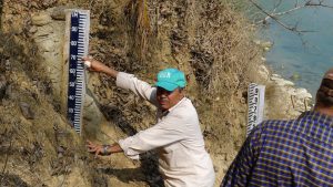
Primary data relevant to natural hazards are collected through fieldwork, while secondary data are obtained from historical archives. Satellite data is also utilized to supplement the information gathered on-site. GIC then applies hazard models according to established standards and definitions to enhance the understanding of potential hazard impacts.
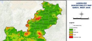
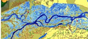
Static maps or dynamic web maps are employed to visualise hazards, providing information on their intensity, magnitude, frequency, and probability of occurrence. GIC has undertaken extensive work in modelling and mapping various hazards. The identification of hazards is tailored to project-specific factors and objectives.